UAV Drone Surveys: How They Work, What They Cost, and How to Get Started (2026)
Last Updated: March 2026
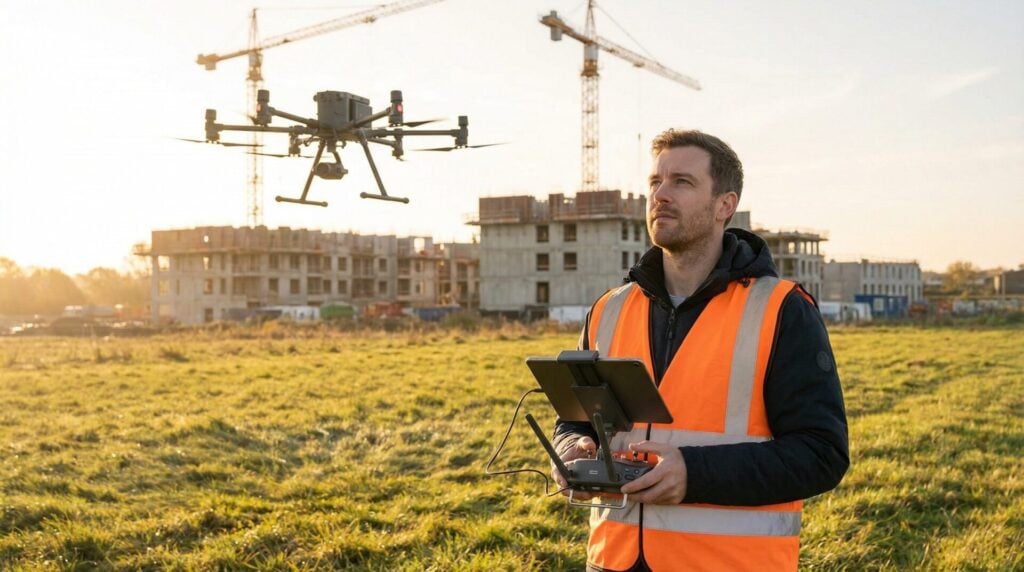
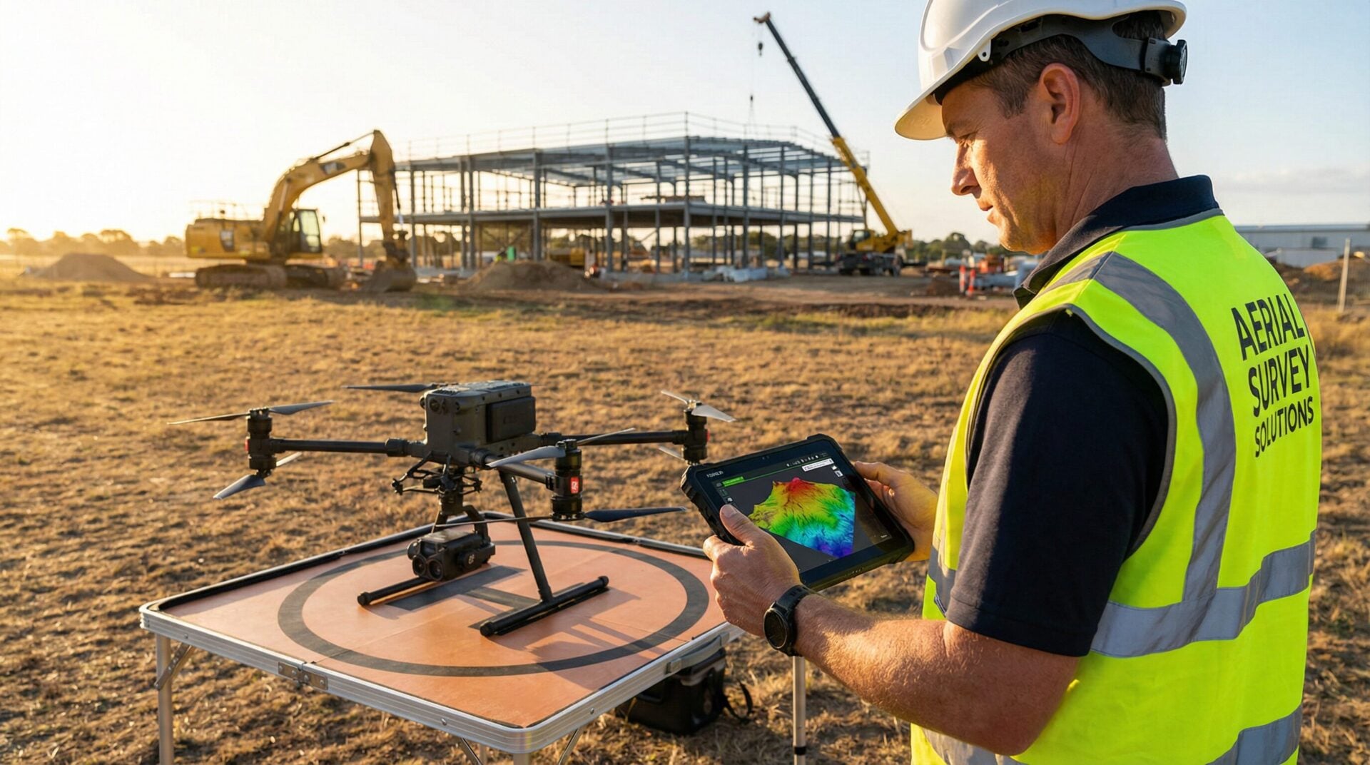
Drone surveys have transformed how construction, engineering, and land development projects collect site data. What used to take days or weeks with a ground crew can now be accomplished in a few hours with a drone, delivering more comprehensive data at a fraction of the cost. But how accurate is it, what does it cost, and how can you get started?
I’m David Young, founder of Drone Launch Academy. With over a decade in the drone industry and having trained over 60,000 students in commercial drone operations, I’ve seen firsthand how drone mapping has gone from a niche technology to an essential tool for professionals. In this guide, I’ll break down everything you need to know about UAV drone surveys.
What Is a UAV Drone Survey?
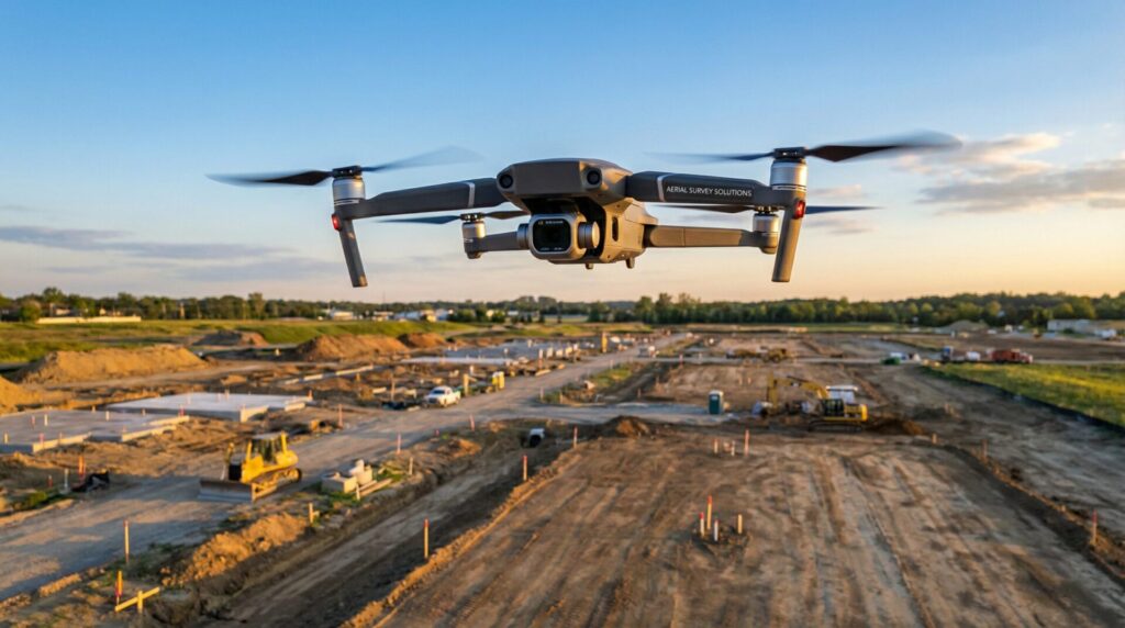
A UAV drone survey is a method of collecting geospatial data using an unmanned aerial vehicle equipped with a high-resolution camera, LiDAR sensor, or multispectral sensor. The drone flies a pre-programmed flight path over a site, capturing overlapping images or point cloud data that software processes into maps, 3D models, and measurements.
At Drone Launch Academy, we’ve used drone mapping for everything from helping local restaurants plan new drive-through lanes to assisting large construction firms with multi-million dollar earthwork projects. The core technologies are photogrammetry and LiDAR, which produce a range of deliverables including orthomosaic maps, 3D point clouds, Digital Elevation Models (DEMs), and 3D meshes.
How Does Drone Photogrammetry Work?
Drone photogrammetry works by flying overlapping photos of a site (typically 70-80% overlap), then processing them through software like Pix4D or DroneDeploy that identifies matching points across images to reconstruct a 3D model of the terrain and structures.
How Accurate Are Drone Surveys?
Drone surveys typically achieve horizontal accuracy of 1-5 cm when using ground control points (GCPs) or RTK-enabled drones. Without GCPs, accuracy drops to 1-3 meters. For most construction and land development applications, drone survey accuracy meets or exceeds the requirements of traditional ground-based surveys.
Several factors affect accuracy, including the use of GCPs, RTK/PPK technology, flight altitude, image overlap, and even weather conditions. A large construction firm we worked with realized some of their settings were off by just a few inches, which could have resulted in hundreds of thousands of dollars in misestimated costs. Accuracy is everything.
| Factor | Drone Survey | Traditional Survey |
|---|---|---|
| Speed | Hours | Days to weeks |
| Cost (10-acre site) | $500-$2,000 | $2,000-$5,000+ |
| Accuracy | 1-5 cm with GCPs | Sub-centimeter |
| Data density | Millions of points | Hundreds of points |
| Safety | Remote operation | Boots on ground |
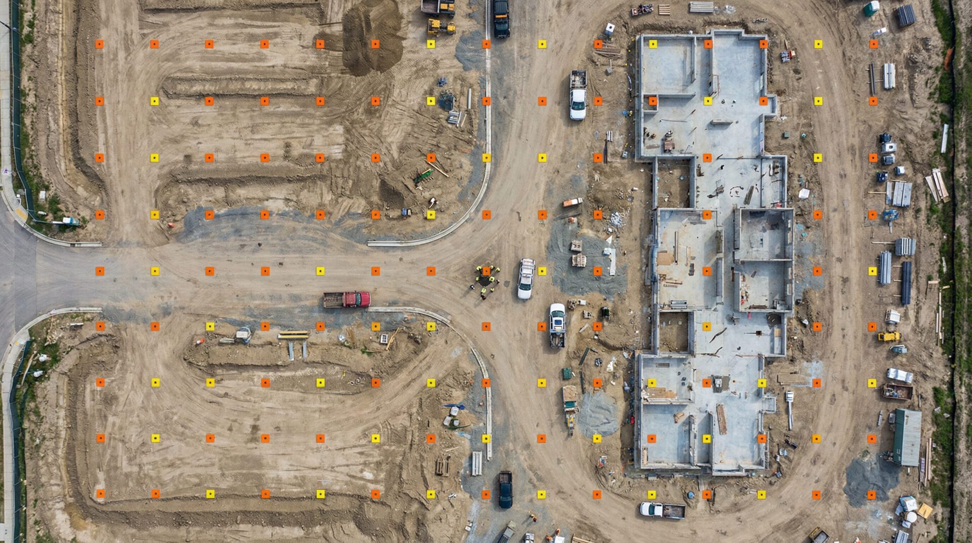
What Are Ground Control Points and Why Do They Matter?
Ground control points (GCPs) are precisely measured markers placed on the ground before a drone flight. They serve as reference coordinates that the processing software uses to align and scale the aerial data, improving accuracy from meters to centimeters. The biggest beginner mistake I see is not understanding what GCPs are or how to use them.
How Much Does a Drone Survey Cost?
Hiring a professional drone survey company costs between $300 for a simple small-site deliverable and $5,000+ for large or complex projects requiring multiple deliverables. If you do it yourself, equipment costs range from $600 for a basic photogrammetry setup to $30,000+ for a professional LiDAR system.
My advice is to always charge per project or deliverable, not hourly. The floor for a simple deliverable is usually around $300, with most projects falling in the low four-figure range.
| Factor | DIY | Hiring a Company |
|---|---|---|
| Small site (< 5 acres) | $600-2,000 equipment + time | $300-$1,000 |
| Medium site (5-50 acres) | Same equipment + time | $1,000-$3,000 |
| Large site (50+ acres) | May need fixed-wing ($5K+) | $3,000-$10,000+ |
| LiDAR survey | $15,000-$30,000+ equipment | $5,000-$15,000+ |
| Recurring projects | Equipment pays for itself | Ongoing per-project cost |
What Equipment Do You Need for Drone Surveying?
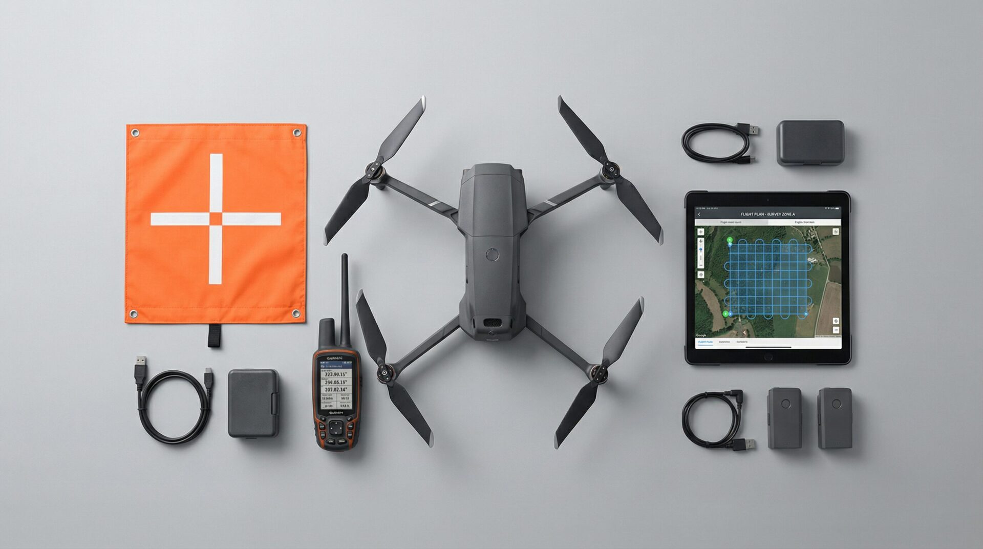
At minimum, you need a drone with a quality camera, flight planning software, and photogrammetry processing software. For professional-grade work, add an RTK-enabled drone and a set of ground control points with a survey-grade GNSS receiver. At Drone Launch Academy, I recommend starting with a DJI Mini 3 and DroneLink for about $600 to learn the fundamentals.
| Level | Drone | Software | Total Cost |
|---|---|---|---|
| Beginner | DJI Mini 3 + Android | DroneLink + free processing | ~$600 |
| Intermediate | DJI Mavic 3 Enterprise | Pix4D or DroneDeploy | ~$5,000-$8,000 |
| Professional | DJI Matrice 350 RTK | Pix4D + Trimble GCPs | ~$15,000-$25,000 |
| LiDAR | DJI Matrice + L2 payload | Pix4D + LiDAR processing | ~$30,000+ |
What Are the Most Common Uses for Drone Surveys?
The most common commercial applications for drone surveys are construction site monitoring, land development planning, mining volume calculations, agricultural crop analysis, infrastructure inspection, and environmental monitoring. Construction and land development represent the largest market segment, with drone surveys replacing traditional methods for progress tracking and earthwork calculations.
We once did a mapping project for a local restaurant that was thinking about adding another drive-through lane. We flew the site and outlined three different options for the new lane and traffic flow, which they used to make their final decision before engaging an engineering firm.
How Do You Perform a Drone Survey Step by Step?
A drone survey follows five main steps: site assessment and flight planning, placing ground control points, flying the automated mission, processing the data in photogrammetry software, and delivering the final maps and models to the client. The entire process for a small site can be completed in a single day.
- Site Assessment and Flight Planning: Review the site for obstacles, airspace restrictions, and safety considerations. Plan your flight path, altitude, and overlap in your flight planning software.
- Placing and Measuring GCPs: Place your ground control points in a distributed pattern across the site and measure their precise coordinates with a GNSS receiver.
- Flying the Automated Mission: Launch the drone and execute the pre-programmed flight. Monitor the drone and weather conditions throughout the flight.
- Processing Data: Transfer the images to your computer and process them in your photogrammetry software, tagging your GCPs and selecting the correct coordinate system.
- Quality Control and Deliverable Creation: Review the processed data for accuracy and completeness. Export the final deliverables (orthomosaic, point cloud, etc.) for the client.
Are Drone Surveys Worth It Compared to Traditional Surveys?
For most applications, drone surveys deliver comparable or better accuracy at a fraction of the time and cost of traditional ground surveys. A site that takes a traditional survey crew two days can be flown and processed in a few hours. The main limitation is that drone surveys can’t replace boundary surveys that require licensed land surveyors.
| Factor | Drone Survey | Traditional Survey |
|---|---|---|
| Speed | Hours | Days to weeks |
| Cost (10-acre site) | $500-$2,000 | $2,000-$5,000+ |
| Accuracy | 1-5 cm with GCPs | Sub-centimeter |
| Data density | Millions of points | Hundreds of points |
| Safety | Remote operation | Boots on ground |
How Do You Start a Drone Survey Business?
Starting a drone survey business requires a Part 107 remote pilot certificate, mapping-capable equipment, photogrammetry software skills, and an understanding of your target industry’s needs. Most successful drone survey businesses start by offering free demo flights to potential clients, then convert those into paying projects once they have case studies to show.
If you’re serious about making a career out of drone mapping, our comprehensive Drone Mapping Course covers everything from flight planning to data processing and client deliverables.
Frequently Asked Questions
What is a UAV survey?
A UAV survey uses an unmanned aerial vehicle (drone) to collect geospatial data for mapping, measurement, and 3D modeling. The drone flies a planned path, captures overlapping images or LiDAR data, and software processes it into maps and models.
How much does a drone survey cost?
Professional drone survey services typically cost $300-$5,000+ depending on site size and deliverables. DIY equipment starts at around $600 for a basic setup capable of producing commercial-quality maps.
Are drone surveys accurate enough for construction?
Yes. With ground control points or RTK-enabled drones, drone surveys achieve 1-5 cm accuracy, which meets or exceeds requirements for most construction applications including earthwork calculations and progress monitoring.
How long does a drone survey take?
A small site (under 5 acres) can typically be flown in 15-30 minutes. Processing takes 1-4 hours depending on the number of images and deliverables. Most projects are completed within a single day.
Do you need a license to do drone surveys?
Yes. In the United States, commercial drone operations require an FAA Part 107 Remote Pilot Certificate. Some states may have additional requirements for surveying work that produces legal boundary documents.
What software is used for drone surveys?
The most popular drone survey processing software includes Pix4D, DroneDeploy, Agisoft Metashape, and WebODM (open source). Flight planning software includes DroneLink, DJI Pilot, and Litchi.
Conclusion
Drone surveying is no longer a niche technology — it’s a core competency for professionals in construction, engineering, and land development. The speed, cost, and data quality advantages are too significant to ignore. Whether you’re looking to hire a drone survey company or start your own, understanding the fundamentals of accuracy, cost, and equipment is the first step.
If you’re ready to master the full drone mapping workflow, I encourage you to check out our in-depth Drone Mapping Course. We bring in industry experts who do this every day to teach you the skills you need to succeed.