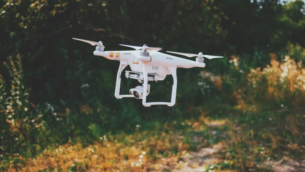
If you’ve ever wondered what aerial surveying is or how professionals use drones to map land, inspect large areas, or collect detailed data from above, you’re in the right place. Aerial surveying has quickly become one of the most in-demand drone skills, opening the door to real career opportunities and high-paying aerial survey jobs.
In this guide, Drone Launch Academy breaks down what is aerial surveying, what it’s used for, and why drone pilots are in a perfect position to take advantage of this fast-growing field.
Want to build a strong foundation in drone mapping and start earning sooner?
Join our drone mapping and modeling fundamentals course and learn essential workflows used by successful drone professionals.
Key Takeaways
- Aerial surveying is the process of collecting accurate land and mapping data from above using drones, planes, or helicopters.
- Knowing what aerial surveying is helps you understand how drones are used in construction, engineering, agriculture, real estate, mining, and environmental monitoring.
- Drones have made aerial land surveying faster, safer, and far more affordable than traditional ground surveys.
- An aerial drone survey can produce orthomosaic maps, 3D models, elevation data, and high-resolution images used across many industries.
- Aerial survey pilot jobs are growing quickly as more companies rely on drone data.
- Learning aerial photography surveying and mapping skills opens up strong opportunities for freelance work and full-time careers.
- Drone Launch Academy offers expert-led training to help you build real-world mapping and surveying skills so you can start earning confidently.
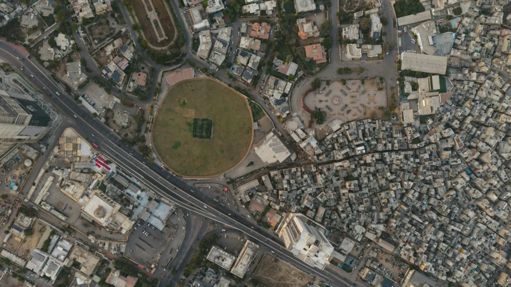
What Is Aerial Surveying?

Aerial surveying is the process of collecting high-quality data about land, terrain, or structures from above using drones, airplanes, helicopters, or other aircraft.
Aerial surveys capture data like:
- High-resolution photos
- LiDAR scans
- 3D models
- Terrain elevation
- Orthomosaic maps
- Infrared or thermal imagery
What Is an Aerial Survey Used For?

Here are the most common real-world uses:
1. Construction & Engineering
One of the biggest industries that uses aerial surveys is construction. Drone-based land surveying helps teams:
- Measure stockpiles
- Track site progress
- Capture as-built documentation
- Identify grading issues
An aerial survey of land can cover an entire project in a few minutes — something that used to take hours or even days on the ground.
2. Mapping & GIS
Drones generate detailed orthomosaic maps and 3D models used by surveyors, GIS analysts, and civil engineers. This is where aerial land surveying becomes extremely valuable.
3. Environmental Monitoring
Aerial surveys allow teams to monitor vegetation, erosion, flood zones, and wildlife without disturbing the land.
4. Agriculture
An aerial drone survey can identify crop health, irrigation issues, and soil variation.
5. Real Estate & Land Development
Developers rely on aerial photography and drone mapping to understand property lines, topography, and access points.
6. Mining & Quarrying
Drone data helps measure volumes, track changes, and keep crews out of hazardous ground areas.
Ready to master advanced mapping, build a professional portfolio, and start earning premium rates?
Enroll in our advanced drone mapping course today and learn proven workflows used by pro pilots.
How Aerial Surveying Works (And Why Drones Changed Everything)
Before drones, aerial surveys were done with planes or helicopters. That meant:
- High costs
- Longer project times
- Limited accessibility
- Only large companies could afford them
Today, drone technology has made land surveying and mapping more accurate, efficient, and affordable.
Here’s how a typical drone-based aerial survey works:
- Plan the flight path using mapping software
- Launch the drone for a fully automated flight
- Capture overlapping images or LiDAR data
- Upload the files into the processing software
- Generate maps, 3D models, and measurement reports
Careers: Aerial Survey Jobs Are Growing Fast
Aerial surveys are real, well-paid, and in demand.
There are several types of opportunities:
- Aerial survey pilot jobs for engineering firms
- Drone operator for GIS or mapping companies
- Drone technician for construction or land development teams
- In-house mapping specialist for utility companies
- Freelance drone mapper offering aerial surveys to local businesses
Why Aerial Surveying Matters for Drone Pilots
If you’re a drone pilot (or looking to become one), learning aerial surveying is one of the smartest moves you can make.
- It’s one of the highest-paid niches in the drone industry
- Mapping and modeling services are needed in every city
- Construction and engineering companies rely on drone data every week
- It’s a skill that creates long-term, repeat clients
- Drone pilots who know land surveying workflows earn more
How Drone Launch Academy Can Help You

Want to turn drone skills into real income? Drone Launch Academy makes it simple. Here’s what you get:
- Training from real industry pros — experts in mapping, surveying, photography, inspections, and more.
- Step-by-step lessons that break down complex topics into easy, actionable workflows.
- Courses for every level — part 107 test prep course, drone mapping, aerial photography, business building, and more.
- Practical, field-tested skills you can start using on paid jobs right away.
If you’re ready to boost your skills, win better clients, and open the door to high-paying drone work, Drone Launch Academy gives you everything you need to get there.
Want to move into higher-value mapping and surveying work?
Drone mapping can open the door to construction, engineering, surveying, and infrastructure projects, but clients expect accurate deliverables and professional workflows. Drone Launch Academy’s Advanced Drone Mapping & Modeling Program teaches the technical skills behind mapping, GNSS, survey control, construction deliverables, land surveying, and 3D modeling.
Download the Drone Mapping Deliverables Checklist
Mapping clients do not just want photos; they want usable deliverables. This checklist helps you understand common outputs such as orthomosaics, contour maps, stockpile measurements, cut-and-fill reports, 3D models, and progress documentation.
Want to explore the foundational mapping course first?
If you are newer to drone mapping, Drone Launch Academy’s Drone Mapping & Modeling Fundamentals course is a strong starting point before moving into the advanced program.
Drone mapping is one of the best ways to move beyond basic aerial photos and into higher-value technical work. The pilots who succeed in this niche understand accuracy, deliverables, data processing, and how to communicate with clients who depend on reliable measurements. If you want to build those skills, the next step is Drone Launch Academy’s Advanced Drone Mapping & Modeling Program.