According to global market research, the drone services market was valued at $16.15 billion in 2023 and is projected to grow to $312 billion by 2030, reflecting massive demand for mapping, surveying, and inspection services. If you’re wondering how to make money drone mapping in 2026, you’re in the right place.
Drone mapping has become one of the fastest-growing, highest-paying parts of the drone industry—and the best part is, you don’t need a full surveying degree or $20,000 of gear to get started. You do need solid skills, a clear game plan, and the right niche. That’s exactly what we’ll show you in this guide.
At Drone Launch Academy, we’ve trained more than 40,000 drone pilots, and we’ve seen firsthand what works in the field. Today, we’re breaking down everything you need to know to start earning real money with drone mapping services in 2026.
Key Takeaways
- Drone mapping is one of the most profitable drone niches in 2026, with steady demand in construction, engineering, and agriculture.
- You can make real income fast by offering high-value mapping services like 2D maps, 3D models, stockpile volumes, and crop health analysis.
- Skills matter more than gear—training through an advanced drone mapping course helps you stand out.
- Niches like drone mapping for construction, agricultural drone mapping, and advanced GIS mapping offer some of the highest-paying mapping jobs.
What Is Drone Mapping? (And Why Does It Pay So Well?)
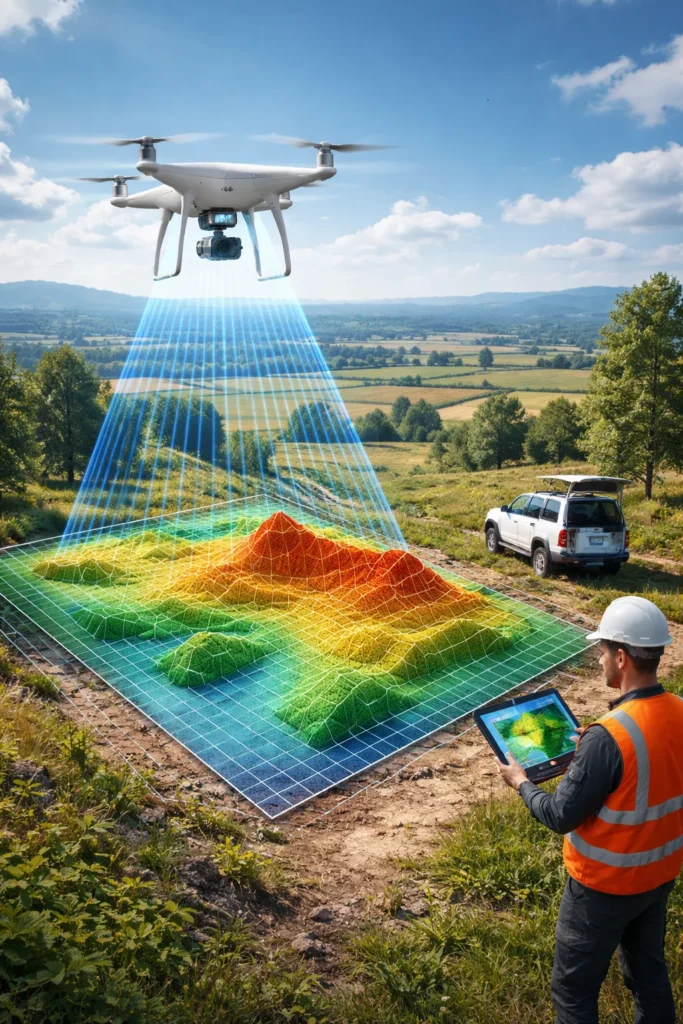
Drone mapping is the process of flying a drone in automated patterns to capture a series of high-resolution images. These images are then stitched together using photogrammetry software to produce:
- Orthomosaic maps
- 2D or 3D site models
- Elevation maps and contours
- Volume measurements (like stockpiles)
- Digital terrain or surface models
- Progress reports
- Visual inspections
Industries now depend heavily on drones for surveying and mapping because drones are faster, safer, and cheaper than ground-based methods. That’s why drone mapping jobs have exploded—construction, engineering firms, agriculture, utilities, mining, and even government agencies now use drone maps weekly or monthly. Companies pay well for accuracy, consistency, and clear workflows.
How to Make Money Drone Mapping in 2026: 8 Real Ways to Earn

Below are the most profitable ways to earn money with mapping in 2026. These are based on real client needs, real pilot results, and the real paths our Drone Launch Academy students take after completing our drone mapping courses.
1. Drone Mapping for Construction (Massive Demand Right Now)
Construction is the #1 market for new mappers.
Builders want:
- Weekly site orthomosaics
- As-built documentation
- Stockpile volume calculations
- Cut/fill reports
- Progress documentation for investors
- 3D models for project planning
This is the easiest niche to break into because:
- Construction sites are everywhere
- They need frequent updates
- Many sites don’t have in-house drone programs
Construction mapping can pay anywhere from $500–$1,500 per project, depending on the site size and deliverables.
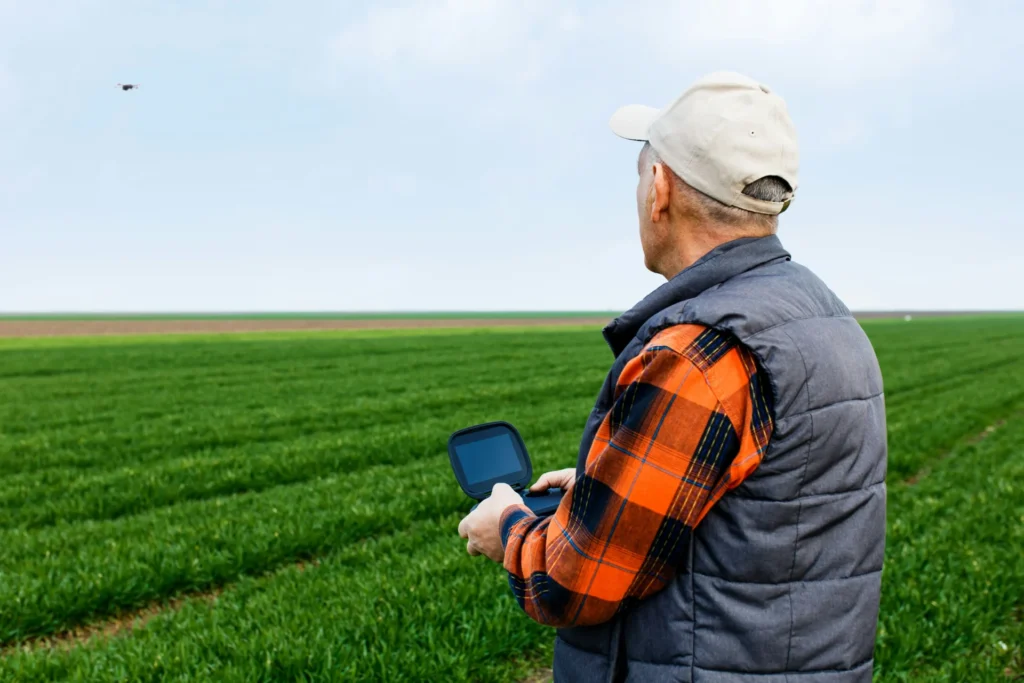
2. Agriculture Drone Mapping (and Why It’s Growing Again)
Drone mapping for the agricultural industry continues to grow as farms adopt digital tools.
Farmers want:
- NDVI plant health maps
- Field boundary mapping
- Irrigation analysis
- Crop stress detection
- Flood and erosion mapping
This niche requires either:
- A multispectral drone or
- Access to cloud processing that supports NDVI analysis
Agricultural mapping can pay $10–$20+ per acre or $500–$2,000 per field (depending on crop type and deliverables).
3. Drone Mapping for Engineering, Surveying & GIS
You don’t need to be a licensed surveyor to offer mapping support. Many engineering firms outsource:
- Pre-design terrain capture
- Volume measurements
- As-built 3D models
- Earthwork quantities
- Environmental site mapping
This is where advanced GIS mapping via drones becomes especially valuable.
How to stay compliant:
You cannot claim to produce legal boundary surveys without a licensed surveyor. But you can provide mapping that surveyors use as part of their workflow. Many small engineering firms hire drone pilots as contractors because they don’t want to own equipment themselves.
This niche can pay anywhere from $800–$3,000+ per project and pays extremely well once you build precision and trust.
4. Real Estate Development & Land Planning
When developers buy land, they need:
- Top-down maps
- Slope analysis
- Elevation models
- Vegetation density
- Site progress imagery
This is a perfect opportunity for new pilots because you can start with simpler deliverables like orthomosaics and grow into more advanced work.
5. Mining & Aggregates (Volume Measurements)
Mining companies constantly measure:
- Stockpiles
- Materials
- Blast analysis
- Changes over time
Drones make this 10x faster than manual measurement.
Typical earnings can range from $1,000–$2,000 per monthly visit. If you master GCP placement and data accuracy, you can land recurring monthly contracts.
6. Environmental Monitoring
Environmental teams use mapping for:
- Wetland documentation
- Shoreline and coastline erosion
- Flood analysis
- Restoration tracking
- Wildlife area monitoring
- Fire burn assessments
This niche is growing especially quickly as climate and environmental reporting becomes standard in government and corporate operations.
7. Drone Mapping Jobs for Government and Municipalities
Cities and counties increasingly hire drone mappers for:
- Land use surveys
- Roadway documentation
- Utility right-of-way mapping
- Stormwater system planning
- Traffic and transportation studies
These contracts often last months or years.
8. Building a Drone Mapping Business and Selling Services Directly
If you want the highest earnings, build your business around drone mapping services and offer:
- Packages
- Monthly retainers
- Project bundles
This approach works best once you’ve completed a drone mapping course, earned your drone mapping certification, and practiced real workflows.
Ready to take the first step to higher earnings?
Why Drone Mapping Is One of the Best Money-Making Drone Niches in 2026

There are tons of drone services—real estate, photography, inspections—but mapping stands out for two big reasons:
- High demand
- Construction alone needs constant site updates.
- Agriculture wants crop insights.
- Mining needs volume reports.
- Environmental teams need ongoing surveys.
All of this requires mapping—weekly, monthly, or quarterly.
- Higher pay than most drone work
- Standard photography gigs might earn $200–$400.
- Mapping projects often earn $500 to $1,500 per job, sometimes much more.
- If you specialize in drone surveying and mapping or advanced GIS mapping via drones, you can charge $150–$300+ per hour.
What You Need to Start Making Money from Drone Mapping
Now that you know where the money is, here’s what you actually need to get started.
1. A Solid Understanding of Mapping Workflows
This is the biggest advantage you can have. Flying a drone is easy. Producing accurate, reliable data is not, which is why trained pilots earn more.
Good mapping requires:
- Proper flight planning
- Correct overlap and altitude settings
- Consistent lighting
- Sharp imagery
- Correct ground control point (GCP) workflow
- Manual GCP marking
- Understanding reprojection error
- Knowing when you need RTK or PPK
This skillset is exactly what we teach in our drone mapping and modeling fundamentals course. If you want to earn good money from drone mapping, skill-building must come before marketing.
2. Drone Equipment (Start Small, Upgrade Later)
You don’t need a $20K kit to start earning money. A simple Air 2S + software + training can get you into real work.
| Recommended beginner setups |
|
| For higher accuracy |
|
| Pro-level (optional later) |
|
3. Mapping Software
Common apps include:
- Pix4D
- DroneDeploy
- WebODM
- RealityCapture
- Agisoft Metashape
Each has strengths. Pix4D is preferred for accuracy-focused industries. DroneDeploy is great for quick reports.
4. Drone Mapping Training & Certification
While you don’t need a government license beyond Part 107, clients take you more seriously if you have:
- Drone mapping certification (industry-recognized programs like ours)
- Hands-on training
- Real-world portfolio work
Our Advanced Drone Mapping & Modeling program was built specifically for professionals who want to charge top rates.
If you’re serious about learning how to make money with drones, proper training will put you way ahead of 90% of drone pilots in the field.
5. Build a Portfolio (Even Before Your First Paid Gig)
Start with:
- Sample construction sites
- Public parks
- Fields
- Parking lots
- Your neighborhood
Turn each dataset into:
- A sample orthomosaic
- A 3D model
- A volume report
- A DEM or contour map
This becomes your proof-of-skill for clients.
How to Find Drone Mapping Clients in 2026
Once you have the skills, here’s how to actually land paying clients.
- Contact Local Construction Companies: Most small- to mid-sized contractors don’t have in-house drone programs.
Offer:
- Weekly or monthly updates
- Volume measurements
- Before/after comparisons
- As-built documentation
Construction is the fastest path to real money.
- Reach Out to Engineering, Surveying & GIS Firms: These firms often outsource drone work due to:
- Staffing limitations
- Equipment costs
- Lack of workflow expertise
If you present yourself professionally, you can land contracts quickly.
- Network at Local Real Estate Developer Meetups: Commercial developers love clear maps and models.
- Contact Farmers in the Agricultural Industry: Farmers are increasingly adopting data-driven tools. A quick demo can easily land a paid job.
- Use LinkedIn to Showcase Your Work:
Post:
- Before/after maps
- 3D models
- Short case studies
- Time-lapse site updates
Professionals love visual proof of value.
- Partner with Other Drone Pilots: Many drone photographers don’t do mapping. You can become their mapping partner.
How Much Drone Mappers Can Earn in 2026
Here’s a realistic breakdown:
| Type of Mapping | Typical Pay |
| Construction mapping | $500–$1,500/project |
| Agricultural mapping | $10–$20/acre or $500–$2,000 |
| Volume measurement | $800–$2,000 |
| Environmental mapping | $600–$2,500 |
| Engineering/GIS mapping | $1,000–$3,000+ |
| Long-term monthly contracts | $1,000–$5,000/month |
How Drone Launch Academy Helps You Succeed
If you want to stand out and actually earn good money, skill matters more than gear.
That’s why we created the following courses:
- Drone Mapping & Modeling Fundamentals
- Advanced Drone Mapping & Modeling (ADMM)
- Drone to $1K Business Bootcamp
These programs help you:
- Learn the full mapping workflow
- Master accuracy & GCP workflows
- Build a real mapping portfolio
- Start earning money faster
- Grow into professional-level projects
Our instructors are actual practitioners—engineers, mappers, surveyors, and industry experts.
If you’re serious about drone mapping, proper training will pay for itself quickly.
Your Path to Making Money with Drone Mapping
Learning how to make money with drones in 2026 isn’t complicated—but it is strategic.
Here’s your roadmap:
- Learn the workflow
- Get proper training for drone mapping
- Build your portfolio
- Choose a niche (construction, agriculture, engineering, etc.)
- Invest in the right gear (start small!)
- Deliver accurate, clean maps
- Build long-term client relationships
- Keep improving your skills
If you follow this path, you can build a profitable, future-proof career offering services that businesses rely on every single week. And if you want expert guidance from professionals who actually work in the field, check out the courses we offer at Drone Launch Academy.
FAQs
Can you make money with drone mapping?
Yes. Drone mapping is one of the most profitable drone niches, with pilots earning $500–$3,000+ per project in construction, agriculture, and engineering.
What is the most profitable drone business?
Drone mapping and surveying support are the most profitable, followed by industrial inspections, construction monitoring, and cinematography.
What is the highest-paying drone job?
High-end drone mapping, industrial inspections (like power lines, bridges, and wind turbines), and specialized GIS work are currently the highest-paying drone roles.
What equipment do I need to start making money with drone mapping?
To begin offering mapping services, you’ll need a drone with a good camera (like the Mavic 3 Classic or Air 2S), flight-planning software, a laptop capable of processing large datasets, and photogrammetry tools such as Pix4D or DroneDeploy. As you grow, consider upgrading to an RTK drone for more accurate drone surveying and mapping projects.
What software is best for drone mapping work?
Common tools used by professionals include:
- DroneDeploy for construction mapping
- Pix4D for 2D maps, 3D models, and advanced GIS mapping
- Agisoft Metashape for high-detail modeling
- QGIS (free) for GIS analysis after processing
Your software choice depends on whether you’re doing agriculture drone mapping, construction, or engineering support.
What industries are newly adopting drone mapping in 2026?
Beyond construction and agriculture, emerging sectors include:
- Solar farm inspections
- Environmental restoration projects
- Water management and flood modeling
- Forestry and tree canopy analysis
- Municipal infrastructure planning
How do I price my service for drone mapping?
Pilots typically charge by:
- Project size (acres)
- Deliverables (orthos, contours, 3D models, NDVI, volumes)
- Turnaround time
- Travel
Typical pricing:
- Small sites: $300–$600
- Construction sites: $800–$2,000+
- Agricultural fields (NDVI): $10–$25 per acre
- Advanced GIS deliverables: Premium rates
Specialists with strong drone mapping training can charge more.
Want to move into higher-value mapping and surveying work?
Drone mapping can open the door to construction, engineering, surveying, and infrastructure projects, but clients expect accurate deliverables and professional workflows. Drone Launch Academy’s Advanced Drone Mapping & Modeling Program teaches the technical skills behind mapping, GNSS, survey control, construction deliverables, land surveying, and 3D modeling.
Download the Drone Mapping Deliverables Checklist
Mapping clients do not just want photos; they want usable deliverables. This checklist helps you understand common outputs such as orthomosaics, contour maps, stockpile measurements, cut-and-fill reports, 3D models, and progress documentation.
Want to turn drone skills into paying clients?
Getting certified is only the first step. If you want a clear roadmap for pricing, outreach, client acquisition, and building a profitable drone business, Drone to $1K walks you through the business-building process step by step.
Drone mapping is one of the best ways to move beyond basic aerial photos and into higher-value technical work. The pilots who succeed in this niche understand accuracy, deliverables, data processing, and how to communicate with clients who depend on reliable measurements. If you want to build those skills, the next step is Drone Launch Academy’s Advanced Drone Mapping & Modeling Program, which is designed to help drone pilots move into professional mapping, surveying, construction, and 3D modeling workflows.