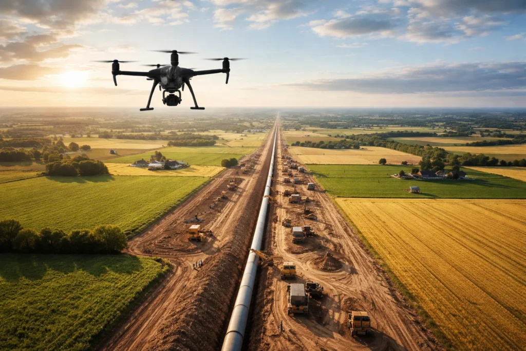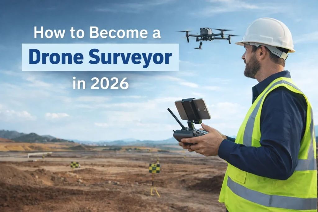
If you’re looking for a high-skill, high-demand drone career, becoming a drone surveyor is one of the smartest moves you can make in 2026. Industries like construction, engineering, agriculture, mining, and infrastructure are relying more than ever on drones to collect fast, accurate data—and they need trained pilots who know what they’re doing.
Drone surveying isn’t just flying a drone around. It combines aviation rules, mapping skills, data accuracy, and real-world problem-solving. The good news? It’s one of the most accessible technical careers you can break into if you follow the right steps.
Drone Launch Academy breaks down how to become a drone surveyor step by step, what skills you actually need, what UAV surveying equipment matters, and what jobs you can find. If you’re a beginner exploring drone surveying, a Part 107 pilot looking to specialize, or a professional interested in building a career or business in drone mapping and surveying, this guide is for you.

Key Takeaways
- A drone surveyor is a certified drone pilot who uses aerial data, mapping software, and survey-grade workflows to measure, map, and model land or structures accurately for professional projects.
- You need an FAA Part 107 Remote Pilot Certificate to legally work as a drone surveyor in the U.S.
- Aerial surveying with a drone combines flying skills, photogrammetry, mapping software, and data accuracy, not just piloting.
- Professional drone surveyors use RTK/PPK-enabled drones and survey-grade workflows to achieve centimeter-level accuracy.
- Most pilots start by working for surveying, engineering, or construction firms before freelancing or starting a business.
- Drone surveyors typically earn $70,000–$80,000 per year, with higher income potential in construction, mining, and infrastructure.
- Specializing in niches like drone mapping, volumetrics, or inspections increases demand and pay.
- Structured training and a strong portfolio help you get hired faster and win higher-value projects.
- Drone Launch Academy provides a step-by-step training path that helps pilots progress from FAA Part 107 certification to advanced drone surveying, mapping, and business-ready skills more quickly.
What Is Drone Surveying and Why It’s Growing Fast
Aerial drone surveying is the process of using drones to collect precise data about land, buildings, and infrastructure. By using a drone for surveying, surveyors can now capture massive datasets in a single flight instead of spending days or weeks measuring sites on foot.
Drone-based surveys are used for:
- Construction progress tracking
- Volume measurements and cut/fill reports
- Topographic mapping
- Agricultural analysis
- Infrastructure inspections
Traditional methods are slow and expensive. By leveraging the advantages of aerial surveys with drones, companies can save time, reduce risk, and obtain better data faster.
How to Become a Drone Surveyor: Step-by-Step
If you’re serious about learning to become a drone surveyor, there’s a clear path you should follow. Skipping steps or guessing your way through usually leads to wasted time and money.
1. Get Your FAA Part 107 License
Before you can do any paid drone work in the U.S., you need an FAA Part 107 Remote Pilot Certificate. This is non-negotiable.
To qualify, you must:
- Be at least 16 years old
- Read, speak, and understand English
- Be physically and mentally fit to fly safely
You’ll need to pass a knowledge exam that covers airspace, weather, regulations, emergency procedures, and flight operations. Once certified, you must complete free recurrent training every 24 months to stay current.
This license is the foundation for UAV land surveying and any other commercial drone career.
2. Learn Surveying and Mapping Skills
Flying is only a small part of the job. Real drone surveying work depends on what you do before and after the flight.
You’ll need to understand:
- Aerial photogrammetry surveying (turning photos into maps and 3D models)
- Flight planning for accurate data capture
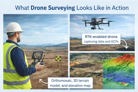
- Ground Control Points (GCPs)
- RTK and PPK workflows
Professional drone surveying training focuses on data accuracy, not cinematic footage. This is where many pilots fail—they can fly well but don’t understand survey-grade results. Taking a structured drone surveying course helps you avoid costly mistakes and learn industry-standard workflows from day one.
Core Skills and Knowledge to Learn
- Flight Operations: Confident, compliant flying, including night operations or BVLOS flights when properly certified.
- Surveying with a Drone Basics: Working with ground control points (GCPs), understanding aerial mapping workflows, and exporting data in required formats.
- Regulatory Compliance: Operating under FAA Part 107 rules, maintaining flight records, and following all airspace limitations.
3. Getting Equipment and Software You Actually Need
Not all drones are built for mapping. Choosing the right UAV surveying equipment is critical for reliable, professional results.
For entry-level work, many pilots start with capable camera drones. But for professional drone mapping and surveying, RTK-enabled platforms are the gold standard.
Common options include:
- DJI Mavic 3 Enterprise RTK
- DJI Matrice 350 RTK
- Fixed-wing drones for large-area projects
A proper drone for surveying must prioritize accuracy over image quality. RTK and PPK workflows enable centimeter-level precision, as clients expect.
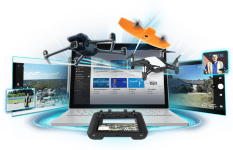
You’ll also need to process your data. Industry-standard tools include:
- Pix4D
- DroneDeploy
- Agisoft Metashape
These platforms turn raw images into orthomosaics, elevation models, and surveying measurements.
4. Build a Career or Business in Drone Surveying
Once you’re licensed and trained, the next step is turning your skills into income.
| Employment Path | Business Path |
Many pilots start by working for:
This route provides hands-on experience and exposure to real uav land surveying projects. It’s also a great way to build credibility and learn how professionals use data. |
If you go independent, you’ll need:
Successful operators bundle services like topographic mapping, volumetrics, and inspections. Specializing in drone surveying niches helps you stand out and command higher rates. |
Most people can move into drone surveying faster than they expect if they follow a structured path.
A typical timeline looks like this:
- FAA Part 107 preparation and testing: 2–4 weeks
- Surveying and mapping training: 4–8 weeks
- Equipment setup and practice: 2–4 weeks
- First paid surveying project: 2–6 months
The timeline shortens significantly when pilots follow a focused training program from a professional drone surveying course rather than learning through trial and error.

Become a Highly Paid Surveyor with Drone Launch Academy
Drone mapping and surveying is one of the higher-paying paths in the drone industry, especially for pilots with mapping and accuracy-focused skills. In the U.S., drone surveyors typically earn between $70,000 and $80,000 per year, with experienced specialists earning $100,000+ annually across industries such as construction, mining, and infrastructure.
Earnings depend on factors like location, technical skill level, software proficiency, and whether you work for a company or operate independently. Freelance surveyors often earn more per project, while salaried roles offer stability and benefits.
How Drone Launch Academy Can Help You
Drone Launch Academy has helped over 40,000 pilots move from beginner to professional by focusing on real-world skills, not just test prep.
Our step-by-step system mirrors the exact journey required for drone surveying success:
- Learn to fly safely and confidently from industry professionals
- Pass the FAA Part 107 exam or your money back
- Build industry-specific skills with recognized certifications
- Turn those skills into a high-paying career or business
With specialized aerial drone surveying training, mapping workshops, and business education, pilots can avoid trial-and-error learning and focus on high-value outcomes. If you’re serious about becoming a drone surveyor, the fastest path forward is structured training that teaches real surveying workflows—not guesswork.
Drone Launch Academy helps pilots move beyond basic flying and into high-value surveying, mapping, and data-driven drone careers with step-by-step training designed for real-world use.
Want to move into higher-value mapping and surveying work?
Drone mapping can open the door to construction, engineering, surveying, and infrastructure projects, but clients expect accurate deliverables and professional workflows. Drone Launch Academy’s Advanced Drone Mapping & Modeling Program teaches the technical skills behind mapping, GNSS, survey control, construction deliverables, land surveying, and 3D modeling.
Download the Drone Mapping Deliverables Checklist
Mapping clients do not just want photos; they want usable deliverables. This checklist helps you understand common outputs such as orthomosaics, contour maps, stockpile measurements, cut-and-fill reports, 3D models, and progress documentation.
Need your Part 107 before you start earning with your drone?
If you plan to fly drones for paid work or in support of a business, your next step is earning your FAA Part 107 Remote Pilot Certificate. Drone Launch Academy’s FAA Part 107 Exam Prep Course is built to help you pass the exam on your first try with structured lessons, practice questions, and lifetime access.
Drone mapping is one of the best ways to move beyond basic aerial photos and into higher-value technical work. The pilots who succeed in this niche understand accuracy, deliverables, data processing, and how to communicate with clients who depend on reliable measurements. If you want to build those skills, the next step is Drone Launch Academy’s Advanced Drone Mapping & Modeling Program.