Last Updated: April 2026
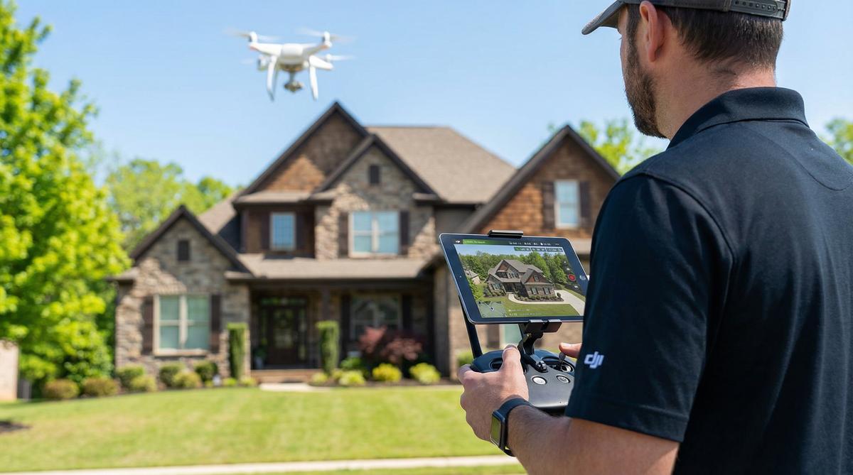
Drone real estate photography uses FAA-certified pilots to capture aerial photos and video of properties, helping listings sell faster and for more money. Pricing typically ranges from $150 to $500 per shoot, and you need a Part 107 license to offer these services commercially.
At Drone Launch Academy, we’ve trained thousands of pilots who now offer real estate photography as a core service. Whether you’re a real estate agent looking to elevate your listings or a drone pilot wondering how to break into this profitable niche, this comprehensive guide covers everything you need to know for 2026.
Key Takeaways:
- Drone real estate photography costs $150 to $350 for residential properties and $500 to $1,500+ for commercial buildings.
- Homes with high-quality aerial photography sell 68% faster than those with standard ground-level photos.
- You must hold an FAA Part 107 Remote Pilot Certificate to offer drone photography commercially.
- The best drones for the job in 2026 include the DJI Air 3S, DJI Mini 4 Pro, and DJI Mavic 4 Pro.
- Successful pilots combine excellent flying skills with a deep understanding of lighting, composition, and post-processing editing.
What Is Drone Real Estate Photography and Why Does It Matter?
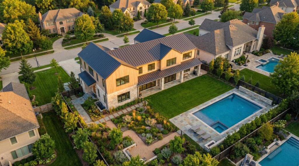
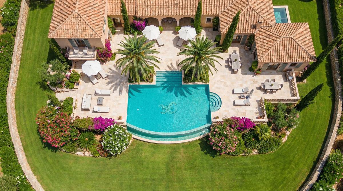
Drone real estate photography involves flying a camera-equipped unmanned aerial vehicle (UAV) over and around a property to capture compelling marketing images and video. The primary goal is to showcase the entire property, its boundaries, and its relationship to the surrounding neighborhood in a way that ground photography simply cannot achieve.
The process is highly effective for marketing properties. Real estate listings that include aerial imagery sell 68% faster than standard listings, and properties marketed with high-quality drone video often command higher final sale prices. By providing a bird’s-eye view, potential buyers can immediately understand the layout of a large lot, the proximity to amenities like parks or schools, and the overall condition of the roof and exterior structures.
Instead of just taking a few pictures from the street, professional drone pilots capture a variety of specific angles. These typically include an elevated front shot that removes visual obstructions like parked cars, an overhead nadir shot that shows property lines, and contextual neighborhood shots. Many pilots also offer video flyovers that create a cinematic, emotional connection for the viewer.
David Young, founder of Drone Launch Academy, emphasizes the value this brings to the real estate market. “Real estate agents are selling a lifestyle, not just a building,” Young explains. “When you provide an agent with stunning aerial footage that highlights a property’s proximity to the beach or a golf course, you’re giving them a powerful tool to justify their asking price and close the deal faster.”
How Much Does Drone Real Estate Photography Cost in 2026?
A standard residential drone real estate photography shoot costs between $150 and $350 in 2026. Commercial properties typically run $500 to $1,500 or more depending on the building size, location, and the complexity of the required deliverables. Adding video flyovers usually increases the base price by $100 to $200.
When budgeting for a drone real estate shoot, several factors influence the final price. The primary driver is the size and complexity of the property. A standard suburban home on a quarter-acre lot takes far less time to photograph than a sprawling 50-acre ranch or a multi-building commercial complex. Location also plays a significant role, with prices naturally skewing higher in major metropolitan areas with a higher cost of living.
The most significant variable, however, is the level of deliverables required. If an agent simply needs a folder of raw, high-resolution photos to edit themselves, the cost will sit at the lower end of the spectrum. If the client requires a fully edited, color-corrected photo package combined with a cinematic video set to licensed music, the price will increase accordingly.
| Service Tier | Price Range | Typical Duration | What’s Included | ||||
|---|---|---|---|---|---|---|---|
| Basic Residential (Photos Only) | $150–$250 | 30–45 min | 10-15 edited aerial photos, basic color correction | ||||
| Residential Photos + Video | $250–$400 | 45–60 min | 15-20 edited photos, 60-second edited video with music | ||||
| Luxury Estate Package | $400–$800 | 1–2 hours | Extensive photo set, cinematic video, twilight/golden hour shots | Commercial Property | $500–$1,500+ | 2–4 hours | Full photo set, video, boundary overlays, neighborhood context |
For those looking to start a drone photography business, pricing your services correctly is crucial. Many beginners make the mistake of charging too little, failing to account for travel time, equipment depreciation, software subscriptions, and insurance costs. A common pricing strategy among Drone Launch Academy alumni is to establish a base rate for standard homes and offer premium add-ons like twilight shoots or interior video walkthroughs to increase the average order value.
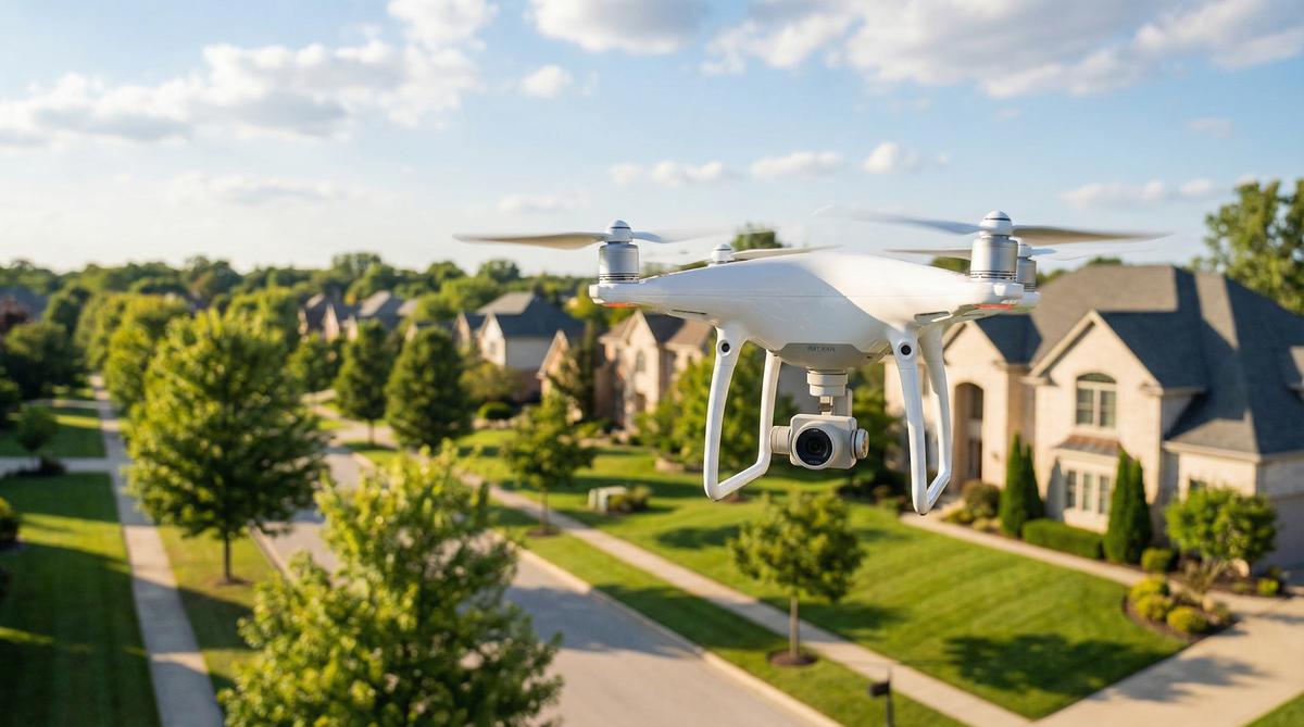
What Are the Best Drones for Real Estate Photography in 2026?
The best drones for real estate photography in 2026 are the DJI Air 3S, the DJI Mini 4 Pro, and the DJI Mavic 4 Pro. These prosumer and professional models offer the ideal balance of high-resolution imaging, reliable obstacle avoidance, and sufficient flight time to complete comprehensive property shoots.
When selecting a drone for real estate work, the quality of the camera is paramount. You need a sensor capable of capturing high dynamic range (HDR) images that can balance bright skies with darker shadows around the property. A 1-inch sensor or larger is highly recommended for professional work, though advanced smaller sensors with computational photography features are increasingly capable.
Battery life is another critical consideration. While a standard residential shoot might only take 20 minutes of actual flight time, commercial jobs or luxury estates require significantly more endurance. Having a drone that can stay aloft for 35 to 45 minutes per battery ensures you can capture all necessary angles without constantly landing to swap power sources.
| Drone Model | Price Range | Camera Specs | Flight Time | Best For |
|---|---|---|---|---|
| DJI Mini 4 Pro | $750–$1,000 | 1/1.3″ CMOS, 48MP, 4K/60fps | 34–45 mins | Beginners, budget-conscious pilots, sub-250g compliance |
| DJI Air 3S | $1,000–$1,500 | 1″ CMOS wide + medium tele, 50MP | 46 mins | Intermediate professionals, excellent all-around value |
| DJI Mavic 4 Pro | $2,100–$3,000 | 4/3 CMOS Hasselblad, 20MP, 5.1K | 45 mins | High-end luxury real estate, commercial properties |
| Autel EVO Lite+ | $1,100–$1,500 | 1″ CMOS, 20MP, 6K/30fps | 40 mins | Pilots looking for DJI alternatives, excellent low-light |
For residential visual inspections and standard real estate photography, you don’t need a $10,000 enterprise rig. The DJI Mini 4 Pro is an excellent entry-level option that shoots 48-megapixel photos and 4K video, all while weighing under 250 grams. Our students at Drone Launch Academy typically start with a prosumer model like this to build their initial client base and generate revenue before upgrading to a more robust system like the Mavic series for luxury listings.
What Camera Settings Should You Use for Real Estate Drone Photography?
For the best real estate drone photos, shoot in RAW format, keep your ISO low (100–200), use an aperture between f/2.8 and f/5.6 for optimal sharpness, and set a shutter speed fast enough to prevent motion blur (typically 1/500th of a second or faster). For video, use ND filters to maintain a cinematic 180-degree shutter angle.
Mastering your camera settings is what separates amateur snapshots from professional real estate marketing assets. Shooting in RAW (DNG format) rather than JPEG is non-negotiable for professional work. RAW files retain vastly more image data, allowing you to recover details in bright skies and dark shadows during the editing process. This dynamic range is essential when photographing homes, which often feature high-contrast lighting situations.
When configuring your exposure triangle, start by locking your ISO at 100. This ensures the cleanest possible image with minimal digital noise or grain. If your drone features an adjustable aperture (like the Mavic series), setting it between f/2.8 and f/5.6 usually provides the sharpest results across the entire frame. Finally, adjust your shutter speed to achieve proper exposure, ensuring it remains fast enough to freeze the motion of the drone.
Video requires a different approach. To achieve smooth, cinematic motion blur, you should follow the 180-degree shutter rule, which states your shutter speed should be double your frame rate. If you are shooting at 4K resolution at 30 frames per second, your shutter speed should be locked at 1/60th of a second. Because this slow shutter speed lets in too much light on a sunny day, you must use Neutral Density (ND) filters — essentially sunglasses for your drone’s camera — to achieve proper exposure without changing the shutter speed.
How Do You Get Into Drone Real Estate Photography as a Business?
To start a drone real estate photography business, you must earn your FAA Part 107 certification, invest in a capable camera drone ($750–$2,000), purchase liability insurance, build a strong portfolio through free or discounted shoots, and actively network with local real estate agents and brokerages.
Getting your Part 107 license is the mandatory first step. Any time you fly a drone for commercial purposes — which includes photographing a house to help sell it — the FAA requires you to be certified. The test covers airspace regulations, weather, drone performance, and safety protocols. Drone Launch Academy’s Part 107 prep course has helped thousands of students pass this exam on their first try, providing the foundational knowledge needed to operate legally and safely.
Once licensed and equipped, your biggest challenge is building a portfolio. Real estate agents are visual buyers; they need to see your work before they hire you. A proven strategy is the “free shoot” approach. Offer to photograph a high-end listing for a prominent local agent at no cost, in exchange for permission to use the images in your marketing materials. This provides you with professional-grade portfolio pieces and often leads to paid work from that agent in the future.
With a portfolio in hand, you must actively market your services. Attend local real estate association meetings, sponsor broker open houses, and maintain a professional website showcasing your best work. Many successful pilots also partner with existing ground-based real estate photographers who want to offer aerial services but don’t want to fly drones themselves, creating a lucrative referral network.
What Are the FAA Rules for Real Estate Drone Photography?
All commercial real estate drone photography in the United States requires an FAA Part 107 Remote Pilot Certificate. You must also comply with Remote ID requirements, fly below 400 feet above ground level (AGL), maintain visual line of sight (VLOS) with your drone, and secure airspace authorization via LAANC when operating near airports.
The Part 107 requirement is strictly enforced. If you are a real estate agent buying a drone to photograph your own listings, you need a Part 107 license. If you are a freelance photographer hired by an agency, you need a Part 107 license. Operating without one can result in severe fines from the FAA and creates significant liability risks for both the pilot and the real estate brokerage.
Airspace authorization is a critical daily consideration for real estate pilots. Many desirable residential neighborhoods and commercial districts are located in controlled airspace near airports. Before launching your drone for a property shoot, you must check an FAA-approved app to determine if authorization is required. If it is, you can usually request and receive it instantly through the LAANC (Low Altitude Authorization and Notification Capability) system.
Additionally, as of 2024, the FAA strictly enforces Remote ID compliance. Remote ID acts as a digital license plate for your drone, broadcasting its identification and location information to local authorities. Most modern drones used for real estate have Remote ID built-in, but you must ensure it is activated and functioning during your flights to remain compliant with federal regulations.
What Tips Help You Take Better Real Estate Drone Photos?
The best real estate drone photos combine the warm, directional lighting of golden hour with a systematic shot list executed from the proper altitude (typically 50 to 150 feet). Avoid flying too high, use grid overlays to keep horizons straight, and always edit your photos to enhance colors and correct lens distortion.
One of the most common mistakes new pilots make is flying too high. While the legal limit is 400 feet, shooting a house from that altitude makes it look like a tiny speck on a Google Earth map. The most flattering angle for residential real estate is typically captured between 50 and 80 feet above the ground. This “elevated tripod” perspective removes ground-level clutter while still clearly showing the facade, roofline, and landscaping in proper proportion.
A professional pilot always works from a standardized shot list to ensure consistent quality. This list should include an elevated front-angle shot, a top-down nadir shot showing property boundaries, a rear-angle shot highlighting the backyard or pool, and high-altitude contextual shots showing the property’s proximity to desirable neighborhood features.
Post-processing is just as important as the flight itself. Even the best RAW photos look flat straight out of the camera. Using software like Adobe Lightroom or specialized real estate editing services, you must correct the white balance, recover highlight details in the sky, lift the shadows, and apply lens profile corrections to ensure straight vertical lines on the building’s architecture.
Frequently Asked Questions About Drone Real Estate Photography
How much do realtors pay for drone pictures?
Realtors typically pay between $150 and $350 for a standard package of drone photos for a residential listing. Packages that include both edited photos and a 60-second cinematic video flyover usually cost between $250 and $500, depending on the local market and the property’s size.
Do I need a license to fly a drone for real estate photography?
Yes. In the United States, any drone flight conducted for commercial purposes requires an FAA Part 107 Remote Pilot Certificate. Because real estate photography is used to market and sell a property, it is classified as a commercial operation, regardless of whether you are a hired photographer or the listing agent flying your own drone.
What kind of drone do I need for real estate photography?
You need a reliable camera drone capable of shooting high-resolution RAW photos and at least 4K video. It should have a minimum flight time of 30 minutes and a stabilized 3-axis gimbal. Popular choices include the DJI Mini 4 Pro for beginners, the DJI Air 3S for intermediate users, and the DJI Mavic series for high-end professional work.
How to get into drone photography for real estate?
To get started, you must first pass the FAA Part 107 exam to earn your commercial license. Next, purchase a capable prosumer drone and practice flying smoothly. Build a portfolio by offering free or discounted shoots to local agents, create a professional website showcasing your work, and then actively market your services to real estate brokerages in your area.
Can I use a DJI Mini for real estate photography?
Yes, the DJI Mini series (specifically the Mini 3 Pro and Mini 4 Pro) is highly capable of producing professional real estate photos and videos. Their 48-megapixel sensors and 4K video capabilities meet the requirements for most MLS listings, and their sub-250-gram weight makes them convenient to transport and operate.
How long does a typical real estate drone shoot take?
A standard residential drone shoot typically takes 30 to 45 minutes on-site. This includes time for a pre-flight safety check, capturing the required photo angles, and filming video flyovers. Larger commercial properties or luxury estates may require one to two hours of flight time.
Do I need insurance to fly drones for real estate?
While the FAA does not legally mandate insurance for Part 107 pilots, carrying drone liability insurance is essential for running a professional business. Most real estate brokerages and commercial clients will require proof of at least $1 million in liability coverage before allowing you to fly over their properties.
Is drone real estate photography worth it in 2026?
Yes, it remains a highly profitable niche. As aerial imagery becomes the standard expectation for property listings rather than a luxury add-on, the demand for skilled, reliable, and legally compliant drone pilots continues to grow, providing a steady stream of revenue for dedicated professionals.
Want to turn drone skills into paying clients?
Getting certified is only the first step. If you want a clear roadmap for pricing, outreach, client acquisition, and building a profitable drone business, Drone to $1K walks you through the business-building process step by step.
Download the Drone Business Launch Checklist
Before you spend more money on gear, map out the business basics: certification, niche, services, pricing, insurance, deliverables, outreach, and follow-up. This checklist helps you turn a drone idea into a focused business plan.
Want your aerial shots to look more professional and help you land paid work?
Great drone photography is a mix of flight skill, camera settings, composition, editing, and client expectations. If you want to improve your aerial media skills, explore Drone Launch Academy’s media-focused courses and then use Drone to $1K to build the business side.
Making money with a drone becomes more realistic when you stop thinking like a general hobbyist and start thinking like a service provider. Choose a niche, understand what clients actually need, build a simple offer, and start consistent outreach. If you want a guided business-building system, Drone to $1K is the next step after certification.


