For drone pilots venturing into mapping and surveying work, establishing accurate coordinate data is essential.
But what happens when you arrive at a site without pre-established survey points?
This is where GNSS post-processing services become invaluable tools in a drone operator’s workflow.
What These Services Actually Do
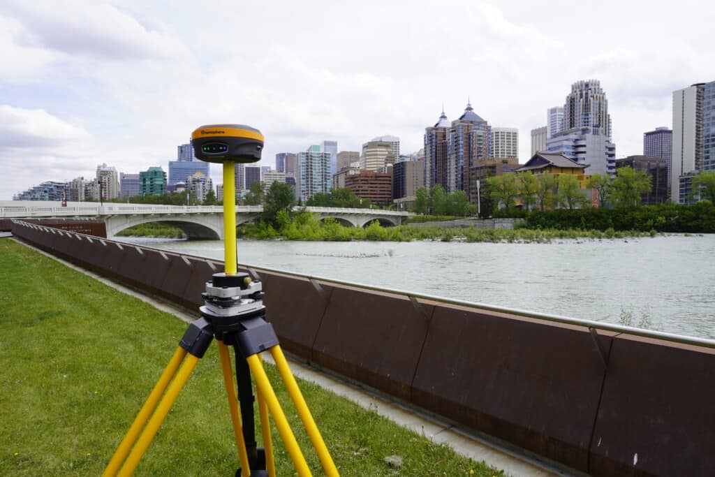
When conducting mapping missions with enterprise-level drones, pilots often employ a PPK (post-processed kinematic) workflow.
This involves bringing a GNSS receiver to the site that logs static data, essentially sitting in one location and recording satellite signals at regular intervals, typically every second.
The challenge arises when there’s no known coordinate already established at that location. Unlike RTK workflows where coordinates are provided by a surveyor, many situations require establishing that initial known point independently:
- First visit to a new site
- No other surveying party involved
- Working independently without established survey control
This is precisely where free post-processing services become invaluable tools.
Two Leading Free Options
The most widely used free GNSS post-processing services are OPUS from the National Geodetic Survey and Trimble’s CenterPoint RTX post-processing service.
Both operate on similar principles but have some notable differences in their requirements and capabilities.
OPUS:
- Offers “rapid static” processing for data logged as little as 15 minutes
- Standard static processing accepts observation periods between 2-48 hours
- Currently only utilizes GPS constellation data (updates planned for the future)
- Well-documented with detailed FAQs and guidance
Trimble’s CenterPoint RTX post-processing service:
- Recommends logging for at least 60 minutes (no hard cutoffs enforced)
- Users report success with shorter periods, though longer is generally better
- Completely free with simple email registration
- Works with multiple receiver brands, not just Trimble equipment
Important Considerations for Both Services
A common misconception is that Trimble’s service only works with Trimble receivers.
In reality, both services support multiple receiver brands, though each maintains specific compatibility lists. Checking compatibility before purchasing equipment is essential.
The timing of when files are uploaded can significantly impact solution quality. Orbital information about satellites becomes more refined over time after data collection. While immediate uploads provide decent solutions, waiting a bit longer improves accuracy. However, most commercial operations involving construction monitoring or volume calculations can’t afford to wait weeks for marginal gains.
Current limitation: OPUS only processes GPS data, ignoring GLONASS, Galileo, and BeiDou signals that modern receivers track. A multi-constellation version is planned but not yet available.
Real-World Performance
Testing has shown that both services typically produce remarkably similar results.
When the same static files are uploaded to both OPUS and Trimble’s service, vertical coordinate differences often measure just a few hundredths of a foot. This consistency suggests that for most applications, either service will deliver reliable results.
That said, OPUS currently has a notable limitation. The production version only processes GPS observations, ignoring data from other satellite constellations like GLONASS, Galileo, or BeiDou that modern receivers typically track. A beta version that incorporated these additional constellations was previously available but has been taken down, with plans to eventually integrate this capability into the main service. The timeline for this update remains uncertain, though despite this limitation, both services continue to provide reliable results for typical drone mapping applications.
Beyond Post-Processing Services
Post-processing services aren’t the only way to establish known coordinates. Alternative methods include:
- Network RTK solutions: Use correction service subscriptions to take multiple observations spaced hours apart, then average them for a reliable known point
- State-level networks: Services like North Carolina’s NCRTN offer affordable annual subscriptions (around $500 for perpetual access)
- Private networks: Various commercial providers offer similar capabilities
- Virtual base stations: Some cloud platforms eliminate the need for logging static data entirely
The advantage of post-processing services is their simplicity—the same receiver collecting mapping data can simultaneously establish base station coordinates.
Practical Applications
For drone service providers, these tools bridge the gap between consumer-level operations and professional surveying work.
The workflow is straightforward:
- Set up a GNSS receiver at the site
- Log static data during the drone flight
- Upload the data to a post-processing service
- Receive accurate coordinates
- Use those coordinates to georeference drone imagery
This process adds minimal time to projects while significantly improving deliverable accuracy. It enables pilots to deliver survey-grade results even when working independently, without immediate access to established survey control.
As GNSS technology evolves and services like OPUS integrate multi-constellation processing, accuracy and reliability will continue to improve.
For drone pilots serious about mapping and surveying work, understanding these free resources and how to leverage them effectively is essential knowledge that directly impacts deliverable quality and business capabilities.
Article By:
Share this post