Last Updated: June 2026
The rapid advancement of drone technology has transformed many industries, but perhaps none more profoundly than surveying and mapping. In 2026, LiDAR is no longer a technology reserved exclusively for massive enterprise operations with six-figure budgets. High-precision laser scanning is now accessible to independent operators and small businesses, creating entirely new career pathways and revenue streams.
If you’ve been wondering how this technology actually functions, what it takes to get involved, and whether the investment is worth the potential returns, you’re in the right place. This guide breaks down the mechanics of drone LiDAR, compares it directly to photogrammetry, outlines the true costs of entry, and provides a clear roadmap for launching your own LiDAR services.
Key Takeaways
- Technology Mechanics: Drone LiDAR utilizes rapid laser pulses to generate highly accurate 3D point clouds, possessing the unique ability to penetrate dense vegetation to map the bare earth beneath.
- Cost of Entry: While prices have decreased, professional entry-level LiDAR setups in 2026 still require an investment of $10,000 to $15,000, with high-end survey-grade systems exceeding $100,000.
- Service Pricing: Qualified operators typically charge between $1,500 and $3,000 per day, or $10 to $150 per acre, depending heavily on the project scope and accuracy requirements.
- Business Pathway: Starting a successful LiDAR operation requires obtaining an FAA Part 107 license, mastering fundamental mapping principles first, and investing in specialized software training alongside the hardware.
What Is Drone LiDAR and How Does It Work?
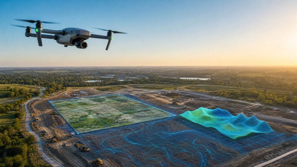
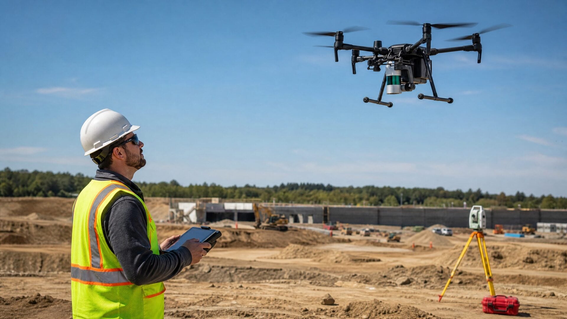
Drone LiDAR is an aerial mapping system that uses laser pulses to measure distances and create highly accurate, three-dimensional models of the earth’s surface and physical structures. By calculating the exact time it takes for a laser beam to hit an object and return to the sensor, the system can determine precise elevations and coordinates.
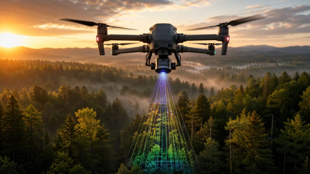
The term LiDAR stands for Light Detection and Ranging. When mounted on a drone, a complete LiDAR system relies on three critical components working in perfect synchronization. First, the LiDAR sensor itself emits hundreds of thousands of laser pulses every second. Second, a Global Navigation Satellite System (GNSS) receiver tracks the drone’s exact location in space. Finally, an Inertial Measurement Unit (IMU) constantly monitors the drone’s orientation, accounting for pitch, roll, and yaw.
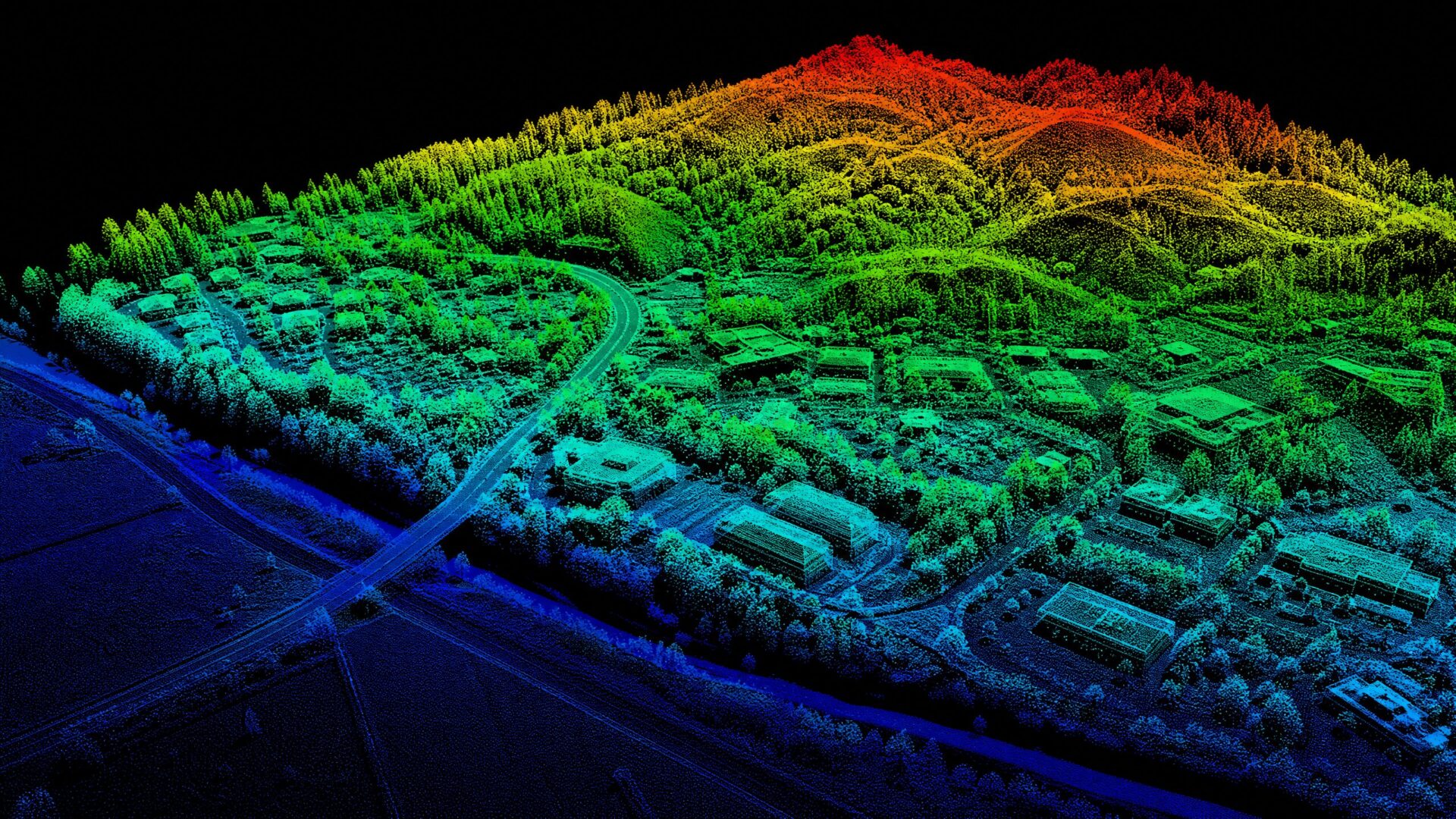
As the drone flies over a site, the sensor fires laser pulses downward. While many pulses hit the top of a forest canopy or a building roof, others slip through small gaps in the leaves or branches. The sensor records multiple “returns” from a single pulse. The first return might be the top of a tree, the second might be a lower branch, and the final return is often the solid ground. This capability to penetrate vegetation is what makes LiDAR uniquely powerful. The resulting data is compiled into a “point cloud” — a massive collection of individual data points that visually represent the surveyed area in stunning 3D detail.
Drone LiDAR vs. Photogrammetry: Which Should You Use?
LiDAR is the superior choice when you need to map terrain hidden beneath dense vegetation or when surveying thin structures like power lines. Photogrammetry, on the other hand, is significantly more cost-effective and is the better option when visual realism, color accuracy, and bare-earth mapping are the primary goals.
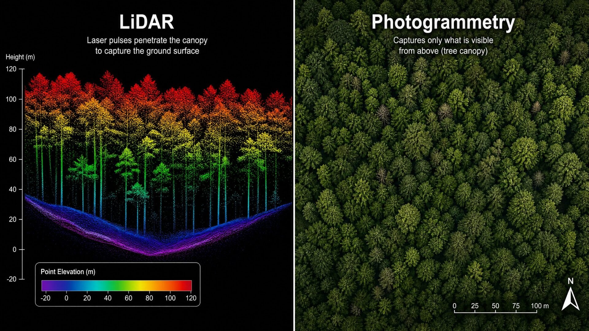
The debate between LiDAR and photogrammetry is common among drone professionals, but the truth is that they’re distinct tools designed for different jobs. Photogrammetry relies on capturing hundreds or thousands of overlapping high-resolution photographs. Specialized software then analyzes these images, identifying common points to stitch them together into a 3D model. Because it uses standard camera sensors, photogrammetry excels at producing photorealistic models with accurate textures and colors. It’s ideal for construction progress monitoring, real estate, and open-pit mining where the ground is clearly visible.
LiDAR doesn’t rely on ambient light or visual contrast. It generates its own light via lasers, meaning it can operate in low-light conditions or even complete darkness. Its primary advantage is structural accuracy and vegetation penetration. If you need to know the exact topography of a heavily forested plot of land before development begins, photogrammetry will only show you the treetops. LiDAR will reveal the ground beneath.
| Feature | Drone LiDAR | Drone Photogrammetry |
|---|---|---|
| Primary Mechanism | Active laser pulses measuring distance | Passive overlapping digital photographs |
| Vegetation Penetration | Excellent (multiple returns reach the ground) | Poor (only models visible surfaces) |
| Visual Output | Point clouds (often colorized later) | Photorealistic 3D models and orthomosaics |
| Lighting Requirements | Independent (can fly in low light/darkness) | Dependent on good ambient lighting |
| Hardware Cost | High ($10,000 to $150,000+) | Low to Medium ($1,500 to $10,000) |
| Accuracy | 2-5 cm absolute vertical accuracy | 3-10 cm with GCPs |
| Best Use Cases | Forestry, power lines, overgrown terrain | Construction monitoring, real estate, open mines |
How Much Does Drone LiDAR Equipment Cost in 2026?
In 2026, a professional entry-level drone LiDAR system will cost between $10,000 and $15,000. Mid-tier systems suitable for most commercial work range from $30,000 to $50,000, while top-tier, survey-grade equipment can easily exceed $100,000.
The cost of LiDAR technology has dropped significantly over the past five years, making it accessible to smaller businesses. However, it remains a substantial investment. When budgeting for a LiDAR operation, you must account for more than just the sensor. A complete setup includes the drone platform capable of carrying the payload, the LiDAR sensor itself, base stations for precise positioning, and specialized processing software.
For example, the DJI Zenmuse L2 paired with a Matrice 350 RTK represents a popular mid-tier option that balances cost with excellent performance. Other industry leaders like YellowScan, Rock Robotic, and Microdrones offer specialized packages tailored to specific industry needs.
It’s crucial to remember the hidden costs. Processing LiDAR data requires robust software licenses, such as DJI Terra or LiDAR360, which often require annual subscriptions. Furthermore, manipulating massive point cloud files demands high-performance computing hardware. A standard office laptop will struggle to process gigabytes of LiDAR data efficiently, meaning an upgrade to a powerful workstation is often necessary. Finally, specialized insurance policies are required to protect such expensive airborne equipment.
How Much Can You Charge for Drone LiDAR Services?
Professional drone LiDAR operators typically charge between $1,500 and $3,000 per day for field collection. When pricing by the acre, rates generally range from $10 to $150 per acre, depending on the complexity of the terrain, the required accuracy, and the final deliverables.
Pricing LiDAR services requires a thorough understanding of your overhead costs and the value you’re providing to the client. Traditional ground surveying of a heavily wooded 100-acre parcel could take a crew several days or even weeks. A LiDAR-equipped drone can capture the same data in a matter of hours. Therefore, you’re not just charging for your time — you’re charging for the speed, safety, and comprehensive data you deliver.
Most operators use a hybrid pricing model. They may charge a day rate for the data acquisition flight, followed by an hourly rate for the back-end data processing and model generation. The processing phase is often where the real expertise is required, as cleaning point clouds and classifying data (separating ground points from trees and buildings) is meticulous work. The return on investment (ROI) for a drone LiDAR business can be substantial, provided you have a steady pipeline of clients in industries that require high-precision topographical data.
Top Industries Hiring Drone LiDAR Pilots Right Now
The most lucrative industries hiring drone LiDAR pilots in 2026 include land surveying, civil engineering and construction, forestry management, and utility infrastructure inspection. These sectors rely heavily on precise topographical data and structural measurements.
Forestry and Agriculture: LiDAR is the gold standard for forestry management. It allows professionals to measure tree heights, estimate canopy density, and calculate timber volume without manual ground measurements. In agriculture, precise topographical maps help in designing efficient irrigation and drainage systems.
Surveying and Topography: Traditional land surveyors increasingly subcontract drone pilots to handle large or difficult terrain. LiDAR provides the foundational data for topographic maps used in land development, flood risk assessments, and environmental conservation planning.
Infrastructure and Utilities: Inspecting power lines, cell towers, and bridges is dangerous and time-consuming work. LiDAR drones can safely fly alongside transmission lines, mapping the exact sag of the wires and identifying any encroaching vegetation that poses a fire hazard.
Construction and Earthworks: Before ground is broken on a new development, accurate earthwork estimates are required. LiDAR helps construction firms calculate the exact volume of dirt that needs to be moved, saving significant time and money during the planning phase.
How to Get Started with Drone LiDAR in 4 Steps
To start a drone LiDAR business, you must first obtain your FAA Part 107 license, master fundamental photogrammetry mapping, invest in specialized LiDAR equipment and software training, and finally build a targeted portfolio to attract commercial clients.
Step 1: Get Your FAA Part 107 License. Before you can fly any drone for commercial purposes in the United States, you must pass the FAA’s Part 107 exam. This certification proves you understand airspace regulations, weather reading, and safe flight operations. Drone Launch Academy offers comprehensive prep courses that guarantee you’ll pass the exam on your first attempt.
Step 2: Master Basic Drone Mapping First. Don’t jump straight into LiDAR. Start with a less expensive drone and learn the principles of photogrammetry. This will teach you essential skills like automated flight planning, understanding overlap, establishing ground control points (GCPs), and navigating mapping software. The operational fundamentals are the same, and making a mistake with a $1,500 drone is much better than crashing a $30,000 LiDAR setup.
Step 3: Get Specialized LiDAR Training. As David Young, founder of Drone Launch Academy, frequently emphasizes, buying the equipment is only ten percent of the job. The real value is in understanding how to process the data. Invest in training courses that teach you how to use software like LiDAR360 or TerraSolid. You must learn how to clean point clouds, classify ground data, and generate the specific deliverables (like Digital Elevation Models) that engineers and surveyors actually want.
Step 4: Build a Portfolio and Pitch Clients. Once you have the equipment and the skills, you need proof of concept. Offer to do a small project at a discount or for free for a local surveying firm in exchange for using the data in your portfolio. Create case studies showing the problem, your LiDAR solution, and the final 3D deliverables. Use these case studies to pitch engineering firms, construction companies, and utility providers.
Frequently Asked Questions About Drone LiDAR
Do I need a special license to fly a LiDAR drone?
You don’t need a LiDAR-specific license, but you must hold an active FAA Part 107 Remote Pilot Certificate to operate any drone commercially in the United States. Additionally, some states require you to work under the supervision of a licensed Professional Land Surveyor (PLS) if you’re establishing legal property boundaries.
How accurate is drone LiDAR?
Modern professional drone LiDAR systems can achieve absolute accuracy of 2 to 5 centimeters (about 1 to 2 inches) when properly calibrated and supported by robust Ground Control Points (GCPs) and RTK/PPK GPS positioning.
Can LiDAR see through solid ground or water?
No. While LiDAR can penetrate the gaps in foliage to reach the ground beneath a forest canopy, the lasers cannot pass through solid earth, rock, or buildings. Furthermore, standard topographic LiDAR uses near-infrared light, which is absorbed by water. Bathymetric LiDAR, which uses green lasers, is required to penetrate and map the bottom of shallow water bodies.
What is the best drone for LiDAR surveying?
In 2026, the DJI Matrice 350 RTK paired with the Zenmuse L2 payload is widely considered the industry standard for balancing cost, reliability, and data quality. For specialized enterprise needs, platforms from Microdrones and Wingtra (for fixed-wing, large-area coverage) are also highly regarded.
Is drone LiDAR better than traditional ground surveying?
It’s not necessarily “better,” but it’s significantly faster and safer for large or hazardous areas. Drone LiDAR is a tool that complements traditional surveying. While a drone can map 100 acres in a day, a licensed surveyor is still required to interpret that data, set physical boundary markers, and legally certify the results.
Conclusion
The integration of LiDAR technology with commercial drones has fundamentally changed how we measure and understand the physical world. While the initial financial investment and the learning curve for data processing are steep, the ability to deliver rapid, hyper-accurate 3D data — especially in challenging, vegetated environments — makes drone LiDAR an incredibly lucrative niche in 2026.
If you’re ready to elevate your drone business beyond basic photography and video, mapping is the logical next step. Start by securing your commercial certification and mastering the fundamentals of aerial data collection. Explore Drone Launch Academy’s Part 107 prep courses and mapping programs to build the foundation you need to succeed in the high-stakes world of drone LiDAR.