
Aerial drone surveying has become one of the most powerful tools for collecting accurate geospatial data at scale. As technology advances and industries demand faster, safer, and more precise insights, the advantages of aerial surveys are more evident than ever for 2026.
From infrastructure planning and construction to environmental monitoring and large-area mapping, aerial surveys allow professionals to capture high-quality data efficiently—often outperforming traditional ground surveys.
As a drone pilot education provider, Drone Launch Academy has trained thousands of professionals in drone skills, including aerial mapping, modeling, and real-world aerial survey pilot jobs. Based on firsthand experience, we’ve compiled the top advantages driving the shift from traditional methods to UAV aerial surveying across industries.
Key Takeaways
- Aerial surveys excel at large-scale coverage, making them ideal for regional mapping, infrastructure corridors, and land development projects where ground or small drone surveys are inefficient.
- High accuracy and data quality are core advantages of aerial photography surveying, driven by advanced sensors such as large-format photogrammetry and airborne LiDAR, often delivering centimeter-level precision.
- Speed and efficiency significantly outperform traditional ground surveying, allowing vast areas to be captured in a single mission and reducing overall project timelines.
- Improved safety is a major benefit, as aerial surveys minimize the need for personnel to work in hazardous, remote, or hard-to-access environments.
- Advanced 3D modeling capabilities enable better planning and decision-making through terrain models, surface models, and BIM-compatible datasets.
- Cost-effectiveness for aerial surveys increases with project scale, especially for large or complex sites where reduced labor, travel, and repeat visits lower total costs.
- Aerial surveys outperform drones and satellites for certain use cases, particularly when high accuracy, fast deployment, urban access, and large-area consistency are required.
What Is an Aerial Survey?
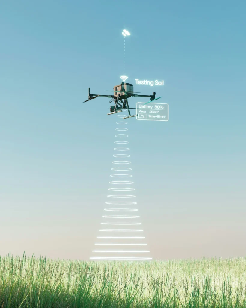
An aerial survey is the process of collecting geospatial data from the air using aircraft or unmanned aerial systems equipped with high-resolution cameras, LiDAR, thermal sensors, and other remote sensing technologies.
Aerial survey companies are commonly hired to produce:
- Topographic maps
- Orthomosaic imagery
- 3D terrain and surface models
- Infrastructure and corridor mapping
- Environmental and land-use assessments
Unlike ground surveying, aerial surveys capture a bird’s-eye view of large areas, delivering consistent, high-accuracy datasets in a fraction of the time.
Check out Drone Launch Academy’s Drone Mapping and Modeling Fundamentals course to learn more today!
Top 10 Advantages of Aerial Surveys
Below, we break down the top advantages of aerial photography surveying, explain when aerial surveying is the best choice, and show how professionals are using these methods to make smarter, faster decisions in 2026.
1. Exceptional Speed and Efficiency
One of the most significant advantages of UAV aerial surveying is speed.
Aerial surveys can capture hundreds or thousands of acres in a single mission, dramatically reducing project timelines compared to ground-based methods. Large areas that might take weeks to survey on foot can often be captured in hours.
This efficiency allows organizations to:
- Accelerate planning and approvals
- Respond faster to changing site conditions
- Reduce downtime on construction or infrastructure projects
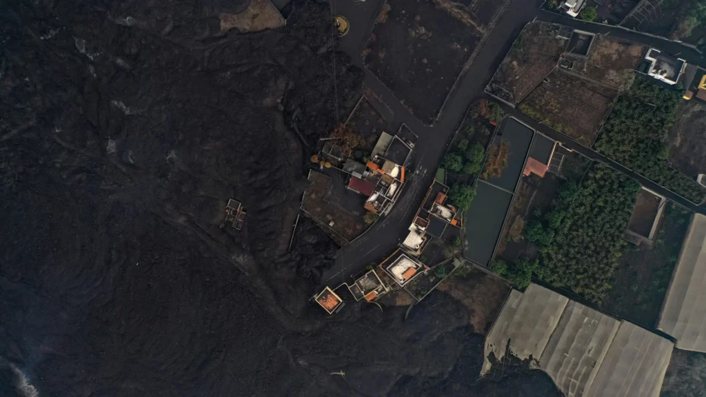
2. Superior Safety for Survey Teams
Aerial drone surveying significantly improves worker safety by keeping people out of hazardous environments.
Instead of sending crews into:
- Steep terrain
- Flood zones
- Disaster-affected areas
- Active construction sites
Surveyors can collect the required data remotely from the air. This reduces the risk of injury while still delivering high-quality, actionable data.
3. High Accuracy and Precision at Scale
Modern aerial survey systems deliver exceptional accuracy, often achieving centimeter-level precision across vast areas.
Using technologies like:
- Large-format photogrammetry
- Airborne LiDAR
- Advanced inertial navigation systems (IMUs)
Aerial surveys provide consistent accuracy that is difficult to match with ground surveys alone—especially over large or complex sites.
This level of precision is critical for:
- Engineering design
- Earthworks calculations
- Flood modeling
- Transportation and corridor planning
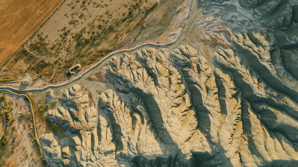
4. High-Resolution Aerial Imagery
Another key advantage of aerial surveying is the ability to capture high-resolution imagery that reveals fine detail across vast regions.
Today’s aerial imaging systems produce:
- Ultra-high-resolution RGB imagery
- Color-infrared data
- Consistent image quality across the entire project area
This makes it easier to identify surface features, track changes over time, and create visually accurate maps and models for stakeholders.
5. Advanced 3D Mapping and Modeling
An aerial mapping survey plays a critical role in 3D mapping and modeling.
By processing aerial imagery and LiDAR data, professionals can generate:
- Digital terrain models (DTMs)
- Digital surface models (DSMs)
- True-to-scale 3D environments
- BIM-compatible datasets
These models improve visualization, reduce design errors, and help teams plan projects more efficiently—before breaking ground.
Check out Drone Launch Academy’s advanced drone mapping course to get started!
6. LiDAR Aerial Survey Benefits
One of the most powerful benefits of aerial surveying comes from airborne LiDAR.
LiDAR aerial surveys can:
- Penetrate vegetation to map bare earth
- Capture millions of precise elevation points
- Provide accurate data in low-light conditions
LiDAR is especially valuable for:
- Forestry and environmental studies
- Floodplain mapping
- Utility and transportation corridors
- Terrain modeling under dense canopy
For large-scale projects, airborne LiDAR often delivers higher efficiency and consistency than ground or drone-only LiDAR systems.
7. Cost-Effectiveness for Large Projects
While aerial surveys may seem complex, they are often more cost-effective than traditional surveying for large or regional projects.
Aerial surveying reduces:
- Labor hours
- Travel and logistics costs
- Repeat site visits
By collecting comprehensive datasets in fewer missions, organizations save both time and money—especially when surveying large or remote areas.
8. Access to Hard-to-Reach Locations
Aerial surveys excel in environments that are difficult or impossible to access on foot.
These include:
- Mountains and steep slopes
- Wetlands and coastal zones
- Dense forests
- Active infrastructure corridors
Because aerial platforms are not limited by ground obstacles, they provide consistent data coverage regardless of terrain complexity.
9. Versatility Across Industries
Aerial survey pilot jobs extend across a wide range of industries, including:
- Construction and infrastructure
- Land development and urban planning
- Mining and natural resources
- Environmental monitoring
- Agriculture and forestry
- Disaster response and recovery
This versatility makes surveying a foundational tool in modern geospatial workflows and aerial surveying jobs.
10. Better Decision-Making with Rich Data
Ultimately, the biggest advantage of aerial surveying is better decision-making.
Aerial surveys deliver:
- Consistent, high-quality datasets
- Faster access to critical information
- Clear visual and quantitative insights
When teams have accurate data early, they can reduce risk, avoid costly mistakes, and move forward with confidence.
Why Aerial Surveying Skills Matter in 2026

As demand for geospatial data continues to grow, professionals with aerial survey and mapping skills are increasingly valuable.
Understanding how aerial data is captured, processed, and applied allows:
- Drone pilots to expand into higher-value work
- Engineers and planners to make data-driven decisions
- Organizations to reduce costs and improve efficiency
This is why aerial surveying and mapping education is becoming a critical career skill.
Learn Professional Aerial Mapping with Drone Launch Academy
As technology continues to evolve, aerial surveying will remain a cornerstone of modern mapping, planning, and infrastructure development—especially for aerial survey companies who know how to use it effectively. At Drone Launch Academy, we help professionals move beyond basic drone flying and into real-world aerial survey jobs.
Our professional training focuses on:
- Practical, field-tested workflows
- Industry-specific use cases
- Turning aerial data into actionable insights
If you want to learn how professionals use aerial mapping surveys and drone mapping in real-world projects, Drone Launch Academy provides practical, industry-led training.
Enroll in the complete advanced program today!
FAQs
What are the benefits of aerial survey over ground surveying?
Aerial surveys collect large-scale, high-accuracy data much faster and more safely than ground surveying, especially across difficult or hazardous terrain.
Are aerial surveys better than drone surveys?
Aerial surveys are better for large-area coverage and corridor-scale projects, while drone surveys are more effective for smaller, site-specific inspections.
What industries benefit most from aerial surveying?
Construction, infrastructure, land development, environmental monitoring, mining, agriculture, and disaster response benefit most from aerial surveying.
How accurate are aerial surveys?
Modern aerial surveys can achieve centimeter-level accuracy using advanced photogrammetry, LiDAR, and precise navigation systems.