
Last Updated: November 17, 2026
The bottom line: Photogrammetry is a strong starting point for visible, open terrain, orthomosaics, and textured models. LiDAR is worth evaluating when you need ground elevations beneath vegetation, because laser pulses can reach the ground through canopy gaps. Neither method is automatically more accurate.
The useful question in the LiDAR vs photogrammetry debate isn’t “Which sensor wins?” It’s “What does the client need delivered, and how will we prove it meets the requirements?” A sharp-looking map, a dense point cloud, and a reliable terrain model aren’t interchangeable. Start with the job, then choose the equipment.
Key Takeaways / TL;DR
- Choose for the output: Photogrammetry fits photographic context and visible surfaces; LiDAR can help with ground observations under vegetation.
- Trees still matter: LiDAR samples gaps. It doesn’t pass through solid leaves, and dense understory can hide the ground.
- Verify accuracy: GSD, point density, RTK, and PPK aren’t substitutes for independent checkpoints.
- Budget the whole job: Include processing, quality checks, training, and professional scope—not just the aircraft and sensor.
What’s the difference between LiDAR and photogrammetry?
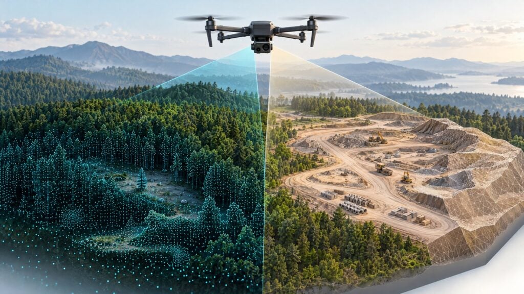
LiDAR measures distances using laser pulses, while photogrammetry calculates geometry from overlapping photographs. Both can produce point clouds and elevation products, but they observe surfaces differently. LiDAR supplies measured ranges; photogrammetry also supplies photographic detail, making the choice depend on what the client needs to see and measure.
LiDAR stands for light detection and ranging. An airborne system sends out laser pulses and measures their return time to calculate distance. Positioning and navigation data help locate those measurements in space. The result is a point cloud: a collection of points representing observed surfaces. USGS explains this process, including how the initial points contain vegetation and structures, not just ground.
Photogrammetry works from images that show the same features from different positions. Software uses those shared features to reconstruct geometry. The photographs also provide color and texture for visual products. Pix4D’s comparison describes the two capture methods and how they can complement each other.
Don’t assume “point cloud” means LiDAR. Photogrammetry produces point clouds, too. If these outputs are new to you, DLA’s drone mapping guide provides a broader introduction.
Which mapping deliverables favor each method?
Photogrammetry is a practical starting point for orthomosaics, textured models, and visible open-site surfaces. LiDAR deserves consideration for terrain beneath vegetation, provided enough ground observations can be collected. Either method may support point clouds, contours, or quantities, but the required output and acceptance tolerance should drive the capture plan.
Use this comparison as a starting point, not a performance guarantee:
| Client need | Method to evaluate first | What to verify |
|---|---|---|
| Open stockpile quantities plus visual context | Photogrammetry | Visible pile surfaces, volume base, coverage, and required tolerance |
| Wooded parcel with bare-earth elevations and contours | LiDAR, with supplemental ground work if needed | Usable ground observations, classification, validation, and professional scope |
| Repeat construction imagery and surface change | Photogrammetry, or a combined workflow | Consistent reference system, capture conditions, and repeat-survey uncertainty |
| Corridor terrain and vegetation with photographic context | LiDAR plus imagery where needed | Required features, coverage, alignment, and specialist interpretation |
An orthomosaic is a geometrically corrected photographic map. A textured model combines 3D geometry with image detail. These are different from a digital surface model (DSM), which represents surfaces such as vegetation and buildings, or a bare-earth digital terrain model (DTM), which represents ground after nonground observations are excluded. USGS describes classification for bare-earth elevation products.
That distinction matters. Contours generated from treetops don’t become ground contours just because the software exported them successfully.
Hypothetical open stockpile: A client wants quantities and a map showing the piles. If the relevant surfaces are visible and reconstruct well, photogrammetry is sensible to evaluate. You still need an agreed base surface for calculating volume, coverage around the pile, and a way to validate the required tolerance. Neither method automatically tells you what’s beneath the material.
Hypothetical wooded parcel: A client wants ground elevations and contours beneath trees. LiDAR may provide observations that camera imagery cannot. Before promising a complete DTM, assess canopy and understory, plan classification checks, and decide where supplemental field measurements may be necessary. Clarify the intended use and licensed-surveying scope before quoting.
Neither example predicts a measured result. It shows how the deliverable changes the decision.
Can LiDAR map the ground beneath trees?
LiDAR can collect ground measurements beneath vegetation when laser pulses travel through openings between leaves and branches. It does not see through solid foliage. Whether a usable bare-earth model is possible depends on canopy gaps, understory, season, viewing geometry, and the distribution of ground points after careful classification.

Photogrammetry can’t reconstruct ground that never appears in its photographs. Better software or additional control points won’t reveal a surface the camera couldn’t observe. Pix4D explains why LiDAR can sample vegetation gaps, rather than penetrate solid leaves.
Some systems record multiple returns from a pulse. A later return might come from a lower surface, but the last return isn’t automatically ground. Points still need classification and inspection. A terrain model interpolated across a large unobserved area deserves different treatment from one supported by well-distributed ground observations.
Active laser sensing also doesn’t mean weather immunity. LiDAR doesn’t need sunlight to send a pulse, but precipitation, visibility, wind, and equipment limits still affect acquisition and safe flight. Photogrammetry needs suitable lighting and image quality. Water, reflections, moving objects, and blocked views deserve scrutiny with either method; don’t assume a standard topographic LiDAR system will map a riverbed.
DLA’s drone LiDAR guide covers the technology more broadly. For a specific site, ask whether the observations actually support the requested terrain product.
Which method is more accurate for drone mapping?
Neither LiDAR nor photogrammetry is automatically more accurate. Compare results against the project’s horizontal and vertical tolerances using independent checkpoints. Relative accuracy describes consistency within the model; absolute accuracy describes alignment with real-world coordinates. Resolution, point density, RTK, and PPK can support a workflow without proving its accuracy.

A model can preserve distances between features reasonably well yet be shifted from its correct location. That’s the distinction between relative and absolute accuracy. Also separate horizontal accuracy, or plan-position agreement, from vertical accuracy, or elevation agreement. Pix4D’s aerial mapping accuracy explanation covers these distinctions.
Ground sample distance (GSD) describes ground spacing between image pixel centers. Smaller GSD means finer image sampling, not a guaranteed positional error. Likewise, a dense LiDAR point cloud doesn’t establish that its points are correctly positioned. Avoid promises based solely on pixel size or point count.
RTK applies positioning corrections in real time; PPK applies them after collection. These approaches can improve positioning inputs, but their presence on a specification sheet doesn’t validate your deliverable. DLA’s RTK vs. PPK guide explains the positioning workflows.
Control points and checkpoints have different jobs. Control helps fit or georeference a product. Independent checkpoints test the finished result and must not also be used to fit it. USGS’s LiDAR processing requirements explicitly separate calibration control from checkpoints. That’s a useful QA principle, not a statement that every commercial project must follow all USGS program specifications.
Before capture, agree on the coordinate reference system, horizontal and vertical datums, tolerances, and validation plan. Distribute checkpoints to test the area and conditions that matter, then report errors, their distribution, and limitations against the agreed requirements. A single convenient check near takeoff won’t tell you everything about a large, varied site.
For a practical follow-up, read DLA’s guide to assessing drone mapping accuracy.
How do the capture-to-delivery workflows differ?
Photogrammetry requires suitable images, overlap, reconstruction, georeferencing, and validation. LiDAR requires scan coverage, reliable positioning and orientation, trajectory processing, calibration checks, classification, and validation. Neither workflow ends when the aircraft lands. Your proposal should include processing, quality checks, and the exact files and limitations the client will receive.

For photogrammetry: Define the output first. Plan image geometry, overlap, GSD, and exposure for the site. Inspect images for blur, gaps, and unsuitable views before relying on reconstruction. Then georeference the product, generate the required outputs, and validate independently. Pix4D describes the overlapping-image foundation of this process.
For LiDAR: Plan scan coverage and positioning requirements. Review the GNSS and inertial measurement unit (IMU) data used to establish sensor position and orientation. Process the trajectory, check calibration and alignment between overlapping flight strips, classify points, and inspect ground coverage before generating terrain outputs. Include independent validation. USGS’s processing guidance provides a reference for these quality checks.
Both workflows need reference-system verification, coverage inspection, and a defined handoff. Does the client want an orthomosaic, classified point cloud, terrain raster, CAD contours, volume report, or several of those? Agree on file formats and limitations, not just “a map.”
Combining imagery and LiDAR can provide geometry and visual context, but their alignment needs checking. A colorized point cloud isn’t automatically a quality orthomosaic. DLA’s mapping software comparison can help you evaluate tools after you’ve defined the processing and delivery requirements.
How should you compare total cost and choose buy, rent, or subcontract?
Compare the cost of delivering an accepted product, not just buying a sensor. Include aircraft compatibility, positioning equipment, software, computing, training, field labor, processing, classification, validation, and potential reflights. Buying, renting, and subcontracting can each make sense depending on recurring demand, available expertise, support, and the project’s required output.
Build quotes around the same area, terrain, deliverables, and tolerance. Otherwise, you’re comparing different jobs.
Your budget should account for:
- Equipment: Aircraft and payload compatibility, positioning equipment, batteries, and supporting field gear.
- Systems: Processing software, computing capacity, storage, and data transfer.
- People: Training, travel, acquisition, processing, classification, and quality reporting.
- Risk: Insurance, support needs, weather delays, missing coverage, and possible reflights.
LiDAR can add trajectory, calibration, and classification work that needs specialist skills. A camera workflow isn’t free of processing or QA costs either. The relevant number is the complete cost of producing an acceptable result.
Buy when recurring demand and staff competence justify ownership. Rent when temporary access makes sense, but confirm integration, support, and your ability to process the data. Subcontract when a specialist can cover a capability gap; define scope, validation, professional responsibilities, and acceptance terms.
A less expensive sensor isn’t a bargain if you must repeat the job or cannot deliver the surface the client requested.
What qualifications and training do drone mappers need?
Commercial drone mapping under Part 107 requires the appropriate FAA pilot qualification and operating compliance, but that does not authorize regulated professional surveying. Check the relevant state board and involve licensed surveyors where needed. Separately, build the planning, processing, coordinate-system, and quality-assurance skills required for the mapping services you offer.
The FAA’s commercial pilot guidance explains Remote Pilot Certificate requirements and keeping aeronautical knowledge current. Your operation must also meet applicable flight and airspace requirements. A different sensor doesn’t change that.
Flight qualification, mapping competence, and professional authorization are three separate issues. For boundary, cadastral, engineering-use, or other potentially regulated services, ask the relevant state licensing board how the proposed work is treated. Partner with licensed surveyors where required. Don’t assume calling a deliverable “mapping” creates an exemption.
If you’re building your skills, start with mission planning, imagery, reference systems, processing, client scoping, and validation. DLA’s Drone Mapping and Modeling Fundamentals covers photogrammetry, overlap, GSD, flight planning, quality and scale checks, client needs, and report delivery. Its instructors are David Young and Rut Patel. DLA’s public About page identifies founder David Young as an FAA-certified Advanced Ground Instructor.
For additional topics, Drone Mapping and Modeling Pro includes DSMs, contour maps, ground control points, 3D models, and analysis. Compare the curriculum with the work you plan to offer.
These courses don’t grant a survey license or establish complete LiDAR competence. LiDAR work also calls for appropriate training in the specific system, trajectory processing, calibration, classification, and QA. Build that capability before promising a deliverable you can’t yet validate.
How do you choose the right method for your next job?
Choose the method that can observe the required surface and deliver the agreed product within its acceptance criteria. Start with intended use, visible ground, tolerance, reference system, legal scope, and validation. Then compare complete workflows and costs. If a single sensor cannot cover the requirements, consider a combined approach.
Before you quote, answer these questions:
- What output will the client use, and for what decision?
- Is the required surface visible, partly hidden, or unobserved?
- What horizontal and vertical tolerances must be demonstrated?
- Which reference system, datums, control, and independent checks will apply?
- Who handles professional scope, processing, QA, and supplemental field work?
- What files, limitations, budget, and acceptance terms are agreed?
That’s the practical answer to LiDAR vs photogrammetry: choose the workflow that fits the job, then prove the deliverable—not the marketing claim.
What are the most common questions about LiDAR vs photogrammetry?
The most common questions concern accuracy, vegetation, relevance, positioning, combined capture, and legal authority. The short answers are consistent: choose for the required output, validate independently, and keep flight qualification separate from surveying authorization. These distinctions matter more than declaring one sensor the winner for every drone mapping job.
Is LiDAR considered photogrammetry?
No. LiDAR measures distance using laser pulses; photogrammetry reconstructs geometry from overlapping images. Both can produce point clouds, but their capture methods are different. They can also be combined when a project needs terrain measurements and photographic context, provided the datasets are correctly aligned and checked.
Is LiDAR always more accurate than photogrammetry?
No. Accuracy depends on the equipment, site, positioning, capture plan, processing, and validation. LiDAR may provide ground observations beneath vegetation that imagery cannot, but that advantage isn’t a universal accuracy guarantee. Compare each finished product against the required horizontal and vertical tolerances using independent checkpoints.
Can LiDAR see through trees?
LiDAR can sample the ground through openings between leaves and branches; it doesn’t see through opaque foliage. Dense canopy or understory can leave ground gaps. A usable bare-earth model requires sufficient ground observations, careful classification, and validation, with supplemental field measurements where the captured data cannot support the requested output.
Is photogrammetry still relevant in 2026?
Yes. Photogrammetry remains useful for orthomosaics, textured models, visible open-site surfaces, stockpile quantities, and repeat visual documentation. Its suitability depends on capture conditions and the client’s requirements. It cannot reconstruct hidden ground simply because processing software improves, and its outputs still need appropriate georeferencing and independent quality checks.
Do RTK or PPK drones eliminate ground checkpoints?
No. RTK and PPK can improve positioning inputs, but they don’t independently prove the final product’s accuracy. Checkpoints test results against known positions and should not also be used to fit the model. Ground control and validation requirements should be planned around the specific deliverable and acceptance criteria.
Can LiDAR and photogrammetry be used together?
Yes. LiDAR geometry and photographic context can complement each other when the project requires both. Plan the combined workflow around the deliverables, then check dataset alignment, coverage, and accuracy. Colorizing a LiDAR point cloud with photographs doesn’t automatically create a quality orthomosaic or validate the terrain model.
Does a Part 107 certificate let me offer land surveying?
A Part 107 certificate is a flight qualification, not a professional surveying license. Whether your proposed service requires licensure depends on the applicable state rules and scope of work. Consult the relevant state board and partner with licensed surveyors where required, especially for boundary or other potentially regulated deliverables.


